What Are Atmospheric River Storms?
Atmospheric river storms are powerful weather systems that channel narrow bands of concentrated moisture from tropical regions to mid-latitude areas. These "rivers in the sky" span thousands of miles and can deliver substantial rainfall, often causing significant flooding and impacting water supply. They play an essential role in weather patterns, particularly on the U.S. West Coast, where they contribute up to 50% of annual rainfall. With climate change, atmospheric river storms are becoming more intense and frequent. Stay with us to uncover more about how these storms shape our climate and their potential future impacts.
Key Takeaways
- Atmospheric rivers (ARs) are narrow corridors transporting concentrated moisture from tropical regions to mid-latitude areas.
- ARs are responsible for 30-50% of annual rainfall in California and contribute to over 80% of major floods.
- Typically 250-375 miles wide, ARs can span thousands of miles in length, carrying immense moisture comparable to 15 times the Mississippi River's flow.
- Climate change is increasing the intensity and frequency of ARs, especially in the Western U.S., posing higher flood risks.
- El Niño events amplify the frequency and intensity of ARs, significantly impacting precipitation and flood patterns in California.
Definition and Characteristics
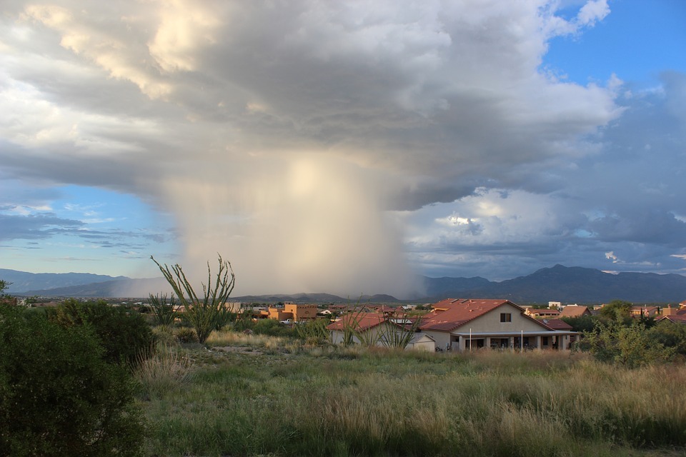
Atmospheric rivers (ARs) are powerful, narrow corridors of concentrated moisture high up in the atmosphere, typically stretching 250-375 miles wide and thousands of miles long. These ARs are like immense rivers in the sky, transporting moisture from tropical regions to mid-latitude areas. They play a crucial role in the global water cycle by influencing precipitation patterns and water supply. Imagine these ARs as colossal conveyors, moving vast amounts of water vapor equivalent to the flow of the Mississippi River. In some cases, exceptionally strong ARs can carry up to 15 times that amount.
In California, atmospheric rivers contribute greatly to the state's annual rainfall, accounting for approximately 30-50% of it. When these ARs make landfall, they often lead to heavy rainfall and extreme weather events. Their ability to transport such vast moisture amounts means they can cause both beneficial and damaging impacts. While they are fundamental for replenishing water supplies, they can also lead to severe flooding and other extreme weather conditions. With 3 to 7 ARs occurring globally at any time, understanding their characteristics helps you appreciate their crucial role and potential risks in our climate system.
Formation and Mechanisms
Forming when warm, moist air from tropical oceans rises over mountain ranges or cooler air masses, atmospheric rivers (ARs) are a fascinating meteorological phenomenon. As this moist air ascends, it cools, leading to condensation and subsequent precipitation. The formation of these weather events hinges on the interplay between high-pressure and low-pressure systems. High-pressure systems can act as barriers, blocking the flow of moisture from the tropics and causing drought conditions. In contrast, low-pressure systems facilitate the rise of moist air, aiding in the formation of ARs.
Imagine:
- Warm ocean waters fueling intense moisture transport into the atmosphere.
- Rising air masses meeting cold mountain ranges, triggering heavy rain.
- High-pressure systems diverting moisture, creating dry spells.
Sea surface temperatures play an essential role in the intensity and frequency of atmospheric rivers. Warmer ocean conditions often correlate with stronger ARs, resulting in more severe precipitation events. Climate change is expected to amplify these effects, potentially increasing both the frequency and intensity of ARs due to improved atmospheric moisture. This makes understanding the mechanisms behind their formation vital as we adapt to a changing climate. Atmospheric rivers, categorized into five levels, can vary from weak to exceptionally intense, with the strongest capable of causing significant flooding and damage.
Impact on Weather and Climate
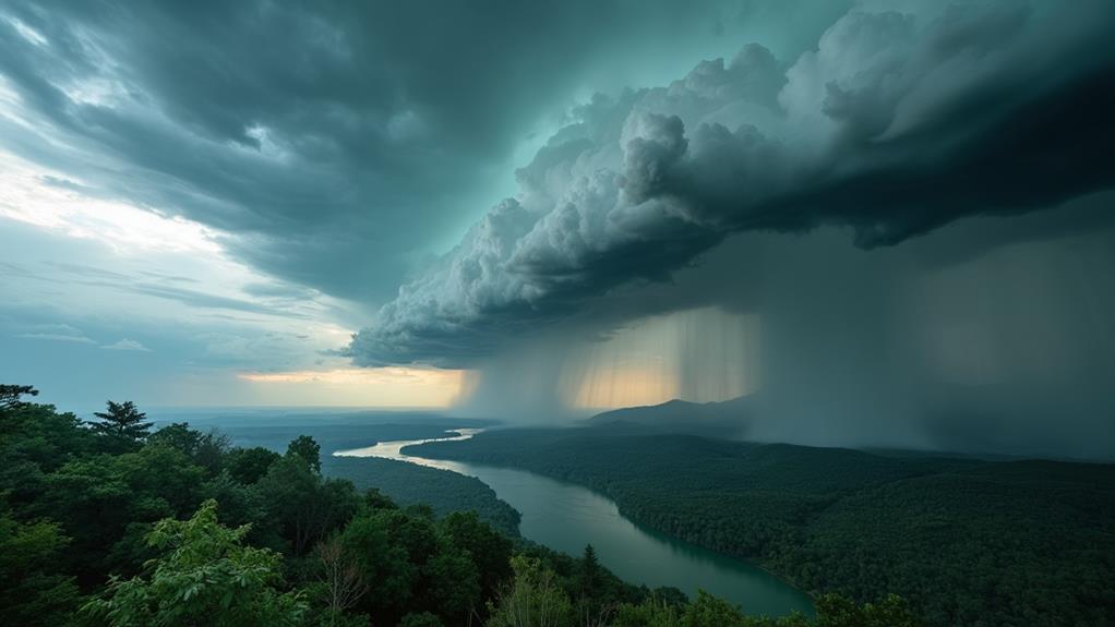
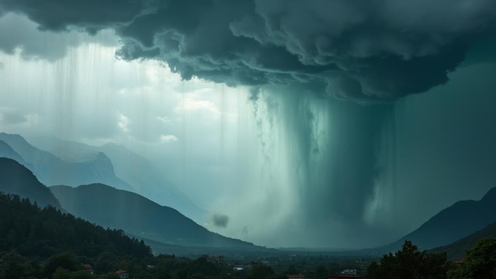
In the domain of weather and climate, atmospheric rivers (ARs) wield a significant influence, shaping regional precipitation patterns and water resources. When ARs make landfall on the West Coast, especially in California, they can account for 30-50% of the state's annual rainfall. This influx of water vapor leads to heavy rain, which is essential for the state's water supply and drought relief efforts. However, it's a double-edged sword; while beneficial for water resources, these systems are also responsible for over 80% of California's major floods.
The extreme precipitation from strong ARs can cause severe flooding, as seen in December 1996, when a Category 4 AR led to $1 billion in damages. According to the National Oceanic and Atmospheric Administration, ARs contribute to 30-40% of precipitation on the U.S. West Coast. This highlights their significance in regional climate patterns but also underscores the risks they pose.
Climate change is projected to amplify the intensity and frequency of ARs, leading to more extreme precipitation events and heightened flood risks. As ARs become more potent, understanding their impact on weather and climate is vital for preparing and mitigating future challenges.
Role of El Niño
El Niño events, characterized by warmer Pacific Ocean waters, can ramp up the frequency and intensity of atmospheric river storms hitting the U.S. During these periods, the subtropical jet stream becomes supercharged, which greatly improves the moisture transport capacity of atmospheric rivers. This results in heavier precipitation and an increase in the number of strong atmospheric rivers impacting California.
In El Niño years, you can expect:
- More frequent storms: An average of 7 to 10 strong atmospheric rivers typically hit California annually, but El Niño years can see even more.
- Heavier rainfall: El Niño conditions often lead to extreme rainfall, which can overwhelm local infrastructure.
- Increased flood risks: Nearly 90% of California's flood damage is from atmospheric rivers, and El Niño exacerbates these storm impacts.
Historical data clearly shows that El Niño correlates with extreme precipitation events linked to atmospheric rivers. This heightened activity greatly contributes to California's flood risks, posing serious challenges for water management and disaster preparedness. So, when El Niño conditions develop, be prepared for the potentially severe impacts of these intensified atmospheric river storms.
Effects of Climate Change

Climate change is dramatically reshaping atmospheric river storms, making them more intense and frequent. As global warming progresses, the Western U.S. is particularly affected, experiencing improved humidity and rising temperatures. These conditions lead to more extreme precipitation events. You'll notice that the intensity and frequency of atmospheric rivers have been increasing, which directly correlates with global warming patterns observed over the past decades.
With warmer atmospheric conditions, there's more moisture available for these storms. This means you can expect a rise in the severity of precipitation associated with atmospheric rivers by the late 21st century. The Fourth National Climate Assessment highlights that atmospheric rivers contribute 30-40% of the precipitation on the U.S. West Coast. This underscores their vital role in both water supply and flood risks under changing climate conditions.
Increased precipitation heightens the potential for flooding, posing significant risks to communities and infrastructure. As these storms grow more severe, the Western U.S. will face challenges in managing water supply and mitigating flood damage. Understanding the effects of climate change on atmospheric rivers is fundamental for preparing and adapting to these evolving weather patterns.
Research and Monitoring
Recognizing the growing intensity and frequency of atmospheric river storms due to climate change, researchers have ramped up efforts to monitor and understand these powerful weather phenomena. Utilizing cutting-edge technology, NOAA employs satellite, radar, and aircraft observations to study atmospheric rivers. This improves forecasting capabilities and augments understanding of their impacts, especially regarding heavy rain and flooding.
Key initiatives include:
- Microwave remote sensing from satellites: This method notably increases water vapor data coverage over oceans, essential for comprehending atmospheric river characteristics.
- The CW3E five-level scale: Developed by the Center for Western Weather and Water Extremes, this scale categorizes atmospheric rivers based on intensity and duration, aiding in monitoring and prediction.
- ARTMIP project: Ongoing research under the Atmospheric River Tracking Method Intercomparison Project focuses on understanding atmospheric river variability and change, yielding numerous scientific publications and fostering collaboration.
Continuous monitoring allows for early warnings, typically predicting heavy rain and flooding 5-7 days in advance. By leveraging advanced technology and collaborative research, scientists aim to mitigate the adverse effects of these powerful storms, providing vital data and forecasts to protect communities.
Frequently Asked Questions
Is an Atmospheric River the Same as a Hurricane?
No, an atmospheric river isn't the same as a hurricane. Atmospheric river characteristics focus on moisture transport mechanisms, carrying vast amounts of water vapor. Hurricane formation differences involve organized systems with strong winds and a defined eye. When comparing storm intensity, hurricanes can be more violent, while atmospheric rivers have broader precipitation patterns. Climate change impacts both, but their geographical distribution varies. Forecasting challenges and societal impacts also differ, with distinct historical examples for each.
What Causes an Atmospheric River Storm?
Imagine a river in the sky, symbolizing moisture transport. An atmospheric river storm forms when warm, moist air from tropical regions combines with weather patterns, raising precipitation levels. Climate impact, like warmer sea surface temperatures, increases storm intensity and flooding risks. These storms can provide drought relief but can also cause severe flooding. Atmospheric science uses satellite imagery to track these storms, which vary with seasonal variations.
What Is the Atmospheric River Weather Event?
An atmospheric river weather event drastically alters weather patterns by transporting massive moisture amounts, often leading to significant precipitation effects. Climate change complicates forecasting these storms, which impact ecosystems and geographic locations like California. Storm intensity varies, with historical events showing severe rainfall. Managing water resources during these events is essential, given their role in both replenishing supplies and causing damage. Predicting their arrival remains a major challenge.
Are Atmospheric Rivers Good or Bad?
Think of atmospheric rivers like a double-edged sword. They have benefits, providing vital water supply and supporting agriculture. However, they also pose flood risks and create infrastructure challenges. Analyzing climate impact shows they affect both positively and negatively. Improved forecasting techniques and public awareness can amplify community preparedness. Balancing their environmental implications is fundamental for managing their dual nature effectively.