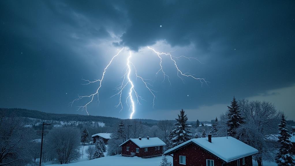
Why Do Supercell Thunderstorms Spawn Tornadoes?
Supercell thunderstorms spawn tornadoes because they combine vital factors like atmospheric instability, strong wind shear, and rotating updrafts called mesocyclones. You have warm, moist air rising and interacting with cooler, dry air, creating instability. Strong wind shear introduces horizontal spinning, which is tilted vertically by powerful updrafts, forming mesocyclones. These rotating updrafts can intensify and tighten, leading to tornado formation. Supercells are distinct because their structure supports these dynamics, making them capable of producing severe weather over prolonged periods. To comprehend the intricacies of how these supercells evolve and lead to tornadoes, there's much more to investigate.
Key Takeaways
- Atmospheric Instability: Warm, moist air rising and interacting with cooler, dry air creates the instability needed for supercell formation and tornado potential.
- Wind Shear: Changes in wind speed and direction with height create horizontal rotation, which updrafts tilt into vertical orientation, forming mesocyclones.
- Strong Updrafts: Powerful updrafts draw in warm, moist air, sustaining storm intensity and organization, crucial for tornado development within supercells.
- Mesocyclone Dynamics: Rotating updrafts (mesocyclones) within supercells indicate strong rotation, a precursor to potential tornado formation.
- Radar Indicators: Doppler radar detects rotating updrafts and features like hook echoes, identifying areas with high tornado potential within supercells.
Key Conditions for Tornado Formation
In regards to tornado formation, understanding the key conditions is crucial. You need to recognize that atmospheric instability plays a major role. This instability occurs when warm, moist air rises and interacts with cooler, dry air aloft, setting the stage for severe weather. One critical factor is the presence of a supercell, a type of thunderstorm known for its potential to produce tornadoes.
Wind shear, defined as the change in wind speed and direction with height, is fundamental. It initiates horizontal rotation within the storm. As the storm intensifies, powerful updrafts tilt this horizontally rotating air into a vertical position, creating a rotating updraft. This vertical rotation is a significant step toward tornado genesis.
The process continues as water vapor condenses within the rotating updraft, forming visible funnel clouds. If these conditions remain favorable, the funnel clouds can develop into tornadoes. Furthermore, downdrafts intensify the mesocyclone, further enhancing the rotation and increasing the likelihood of tornado formation.
Understanding Wind Shear
Understanding wind shear is vital for grasping how tornadoes form within supercell thunderstorms. Wind shear refers to the change in wind speed and direction with height. This phenomenon is fundamental for developing the rotating updrafts that give supercell thunderstorms their defining characteristics. When wind speeds increase and directions shift with altitude, it creates horizontal rotation in the lower atmosphere.
This horizontal rotation can be tilted into a vertical position by powerful updrafts, forming a mesocyclone—a rotating column of air within the storm. A typical wind shear pattern involves light winds at the surface, often from the south, combined with stronger winds aloft from the west or southwest. This setup creates the conditions necessary for supercell formation.
Wind shear intensity is often measured using the vertical wind profile. Moderate to strong wind shear, greater than 20 knots, is ideal for supercells. Significant wind shear helps maintain the separation of updrafts and downdrafts within a supercell, prolonging the storm's life and enhancing its severe weather potential, including the production of tornadoes. By understanding wind shear, you can better appreciate the dynamics that make supercell thunderstorms so powerful and destructive.
Role of Updrafts
While wind shear sets the stage for tornado formation, updrafts play a significant role in bringing the drama to life. In supercell thunderstorms, updrafts are the powerhouse, giving the storm its unique structure and longevity. These updrafts can reach speeds of over 100 mph, tilting the horizontally rotating air caused by wind shear into a vertical orientation. This vertical rotation is a key component in the development of tornadoes.
The updrafts draw in warm, moist air from the surface, which fuels the storm, making it capable of producing severe weather. This moist air is fundamental, as it amplifies the storm's intensity and the potential for tornado formation. Without this continuous supply of warm, moist air, the supercell would weaken and dissipate.
A strong, well-defined updraft is critical for maintaining the supercell's structure and prolonging its life cycle. The longer a supercell persists, the greater its chances of spawning tornadoes. Research shows that the strength and organization of the updraft directly correlate with the tornadoes' intensity and longevity. So, when you see those towering supercell thunderstorms, remember it's the updrafts driving the storm's potential to produce devastating tornadoes.
Mesocyclone Dynamics
The interplay between updrafts and rotating air birthed by wind shear sets the stage for the mesocyclone, the heart of a supercell thunderstorm. You'll find that a mesocyclone is fundamentally a rotating updraft characterized by a counter-clockwise rotation in the Northern Hemisphere. This rotation starts with wind shear, which creates a horizontal spinning effect. When strong updrafts interact with this spinning air, they tilt it into a vertical orientation, forming the mesocyclone.
Now, the strength of a mesocyclone can vary, and stronger ones are often precursors to more intense tornadoes. When a mesocyclone exhibits greater vertical development and organization, it ramps up the potential for tornado formation. Meteorologists can identify these tornado-producing storms using Doppler radar, spotting features like bounded weak echo regions (BWER) and hook echoes, which indicate a well-defined mesocyclone.
The dynamics of mesocyclones aren't just influenced by updrafts and rotation; surrounding atmospheric conditions play a significant role too. Factors like temperature, moisture, and the interaction of varying wind speeds and directions at different altitudes all contribute to the mesocyclone's behavior and its potential to spawn tornadoes.
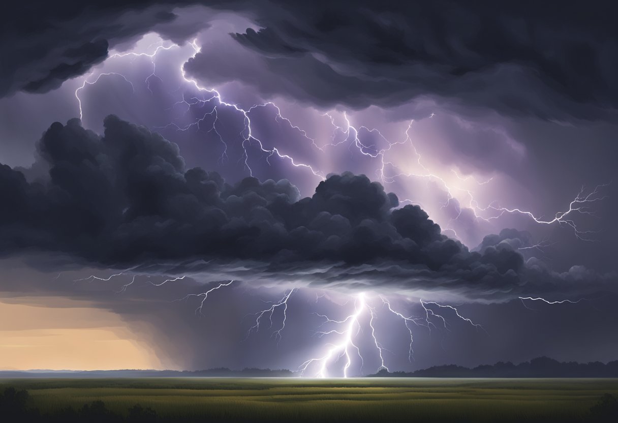
Supercell Characteristics
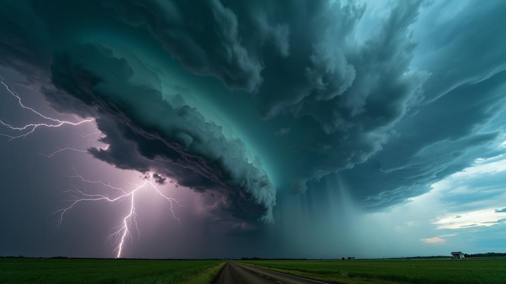
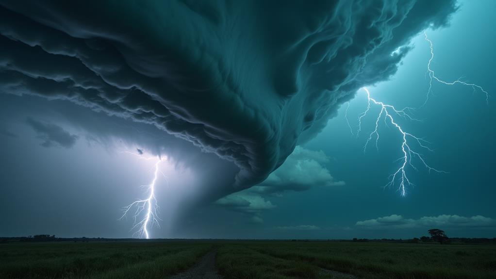
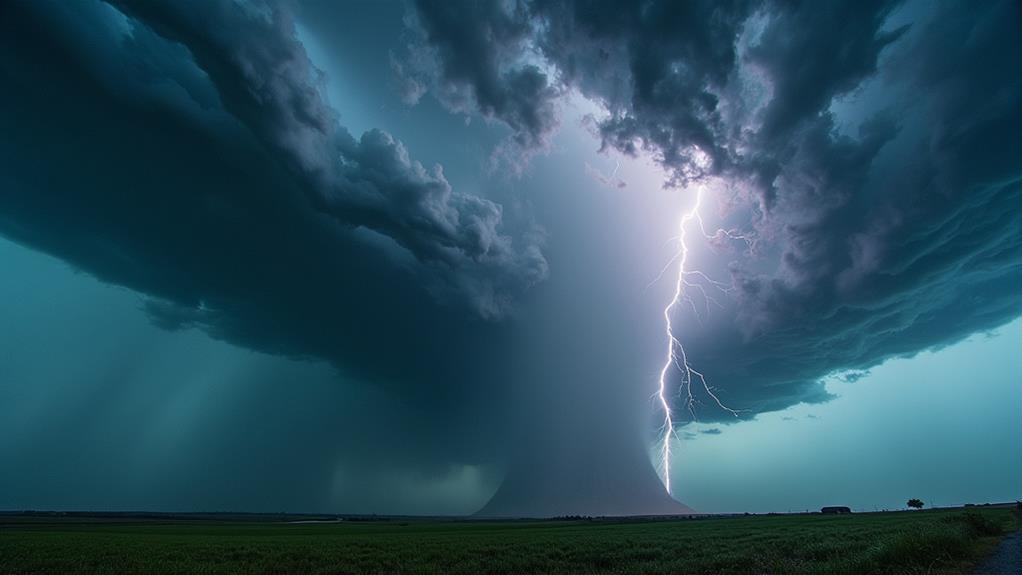
Supercell thunderstorms, with their iconic rotating updrafts or mesocyclones, stand out due to their unique and powerful characteristics. These storms are not only visually stunning but also capable of persisting for hours and traveling great distances. As the rotation begins within the storm, a mesocyclone forms, which is essential for the development of tornadoes. The distinct features of supercells make them fascinating and ominous weather phenomena.
When observing supercells, you'll notice:
- Mothership appearance: The storm often looks like a massive, rotating spaceship.
- Hook echo: On radar, this feature indicates strong rotation and the potential for tornado formation.
- Wall clouds: These lowerings beneath the main updraft base are where tornadoes are associated.
Supercells are classified into low precipitation (LP) and high precipitation (HP) types. LP supercells often have visible structures, making them easier to study, while HP supercells can obscure these features with heavy rain. Despite their awe-inspiring nature, fewer than 20% of supercell thunderstorms actually produce tornadoes, underscoring the complexity of predicting tornado genesis. Understanding these characteristics is essential for appreciating the raw power and unpredictability of supercell thunderstorms.
Radar Detection Techniques
In relation to detecting supercell thunderstorms, Doppler radar stands as an essential tool. It measures wind speed and direction, allowing you to identify rotating updrafts within the storm known as mesocyclones. Spotting these mesocyclones is critical for understanding tornado development within supercells.
One of the key radar detection features to watch for is the hook echo. This distinct radar signature indicates the presence of a rotating updraft and often signals the potential for tornado formation. When you see a hook echo on radar imagery, it's a red flag for possible tornado activity.
Another significant radar feature is the bounded weak echo region (BWER). This area of low radar reflectivity surrounded by higher reflectivity signifies strong rotation and is typically indicative of severe weather, including high likelihoods of tornadoes.
Advanced radar technologies, such as dual-polarization radar, have further improved tornado detection. These systems help differentiate between different precipitation types, thereby enhancing the accuracy of identifying tornado signatures.
Real-time radar data is essential for tracking the evolution of supercells. It provides critical information that enables meteorologists to issue timely tornado warnings, ultimately protecting lives and property.
Tornado Prediction Methods
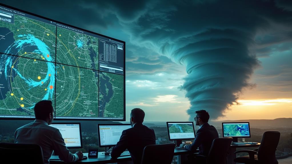
Predicting tornadoes involves a complex blend of technology and meteorological expertise. You'll find that meteorologists rely heavily on Doppler radar technology to detect rotation within severe thunderstorms, which is essential for identifying potential tornado formation. This sophisticated radar system can spot changes in wind direction and speed, allowing experts to pinpoint areas where tornadoes might develop.
Early warning systems are another critical component. These systems utilize real-time data on atmospheric conditions, such as wind shear and moisture levels, to issue alerts for tornado risks. This proactive approach helps keep communities safe by providing timely warnings.
- Doppler radar technology: Detects rotation within thunderstorms.
- Real-time atmospheric data: Monitors wind shear and moisture levels.
- Early warning systems: Issues alerts based on current conditions.
Continuous atmospheric data collection improves predictive models, making forecasts more accurate. By understanding specific conditions that lead to tornado development, such as the presence of supercells and mesocyclones, meteorologists can enhance their prediction accuracy. Public awareness campaigns also play a key role, educating communities about tornado formation and safety measures. This thorough approach guarantees you're better prepared to face severe weather events, considerably reducing the risks associated with tornadoes.
Related Severe Weather Phenomena
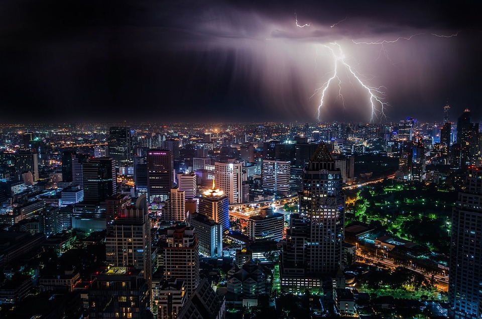
You'll find that the power of supercell thunderstorms goes beyond just tornadoes; they can release a variety of severe weather phenomena. Supercells are notorious for producing large hail, damaging winds, and heavy rainfall. The rising air within these storms contributes to their intensity, sustaining severe storms over extended periods. Wall clouds, which are often precursors to tornadoes, form as a part of this dynamic system, signaling the potential for more violent weather.
While supercells are most commonly associated with violent tornadoes, it's essential not to overlook other severe weather threats they bring. Large hailstones, propelled by strong updrafts, can cause significant damage to property and crops. Damaging winds, sometimes exceeding 70 mph, can topple trees and power lines, creating widespread disruption. Heavy rainfall from supercells can lead to flash flooding, another serious hazard that often accompanies these storms.
Interestingly, not all tornadoes come from supercells. Around 20% of tornadoes are QLCS tornadoes, which form in linearly organized storms. However, these tend to be weaker, usually rated EF2 or lower on the Enhanced Fujita Scale. In contrast, supercells' ability to maintain their structure makes them more likely to produce the most destructive tornadoes, especially during peak seasons in spring and early summer.
Frequently Asked Questions
Why Do Some Supercells Produce Tornadoes?
You wonder why some supercells produce tornadoes while others don't. Tornado formation hinges on supercell dynamics and specific environmental conditions. Strong wind shear, ample atmospheric moisture, and a robust updraft within the storm structure are essential. When these elements align perfectly, the supercell can tilt horizontal rotation into a vertical one, forming a tornado. However, even slight variations in these conditions can prevent tornado development.
Why Do Some Thunderstorms Produce Tornadoes?
You might wonder why some thunderstorms produce tornadoes while others don't. It's all about thunderstorm dynamics and atmospheric instability. When wind shear and moisture levels are just right, the storm's supercell characteristics can create the ideal conditions. Wind shear leads to horizontal rotation, which strong updrafts lift into vertical rotation. Without these perfect ingredients, even similar storms may not spawn tornadoes. It's a delicate balance of nature.
How Long Do Supercell Thunderstorms Tornadoes Last?
Supercell tornadoes generally have a lifespan of 10 to 20 minutes, but they can last over an hour. Their duration depends on formation conditions and environmental factors like wind shear and moisture. The storm structure plays a critical role in how long they persist before undergoing the dissipation process. Stronger supercells often produce longer-lasting tornadoes due to their robust and organized nature, directly affecting the tornado's lifespan.
Why Do Tornadoes Typically Develop on the Rear Flank of a Supercell Thunderstorm?
Ever wonder why tornadoes form on the rear flank of a supercell thunderstorm? Here's the suspenseful secret: supercell dynamics and storm structure create the perfect storm. Wind shear tilts horizontal wind into a vertical spin, enhancing tornado formation. The rear flank, with its unique downdraft, fuels this process. It clears the path for warm, moist air, intensifying the storm's rotation. That's why it's the prime spot for tornadoes.