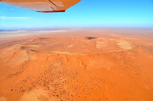
Craters On Earth – Pingualuit Crater
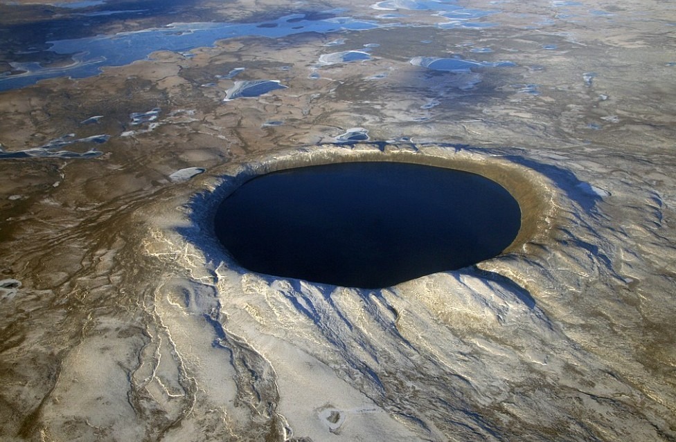
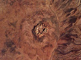
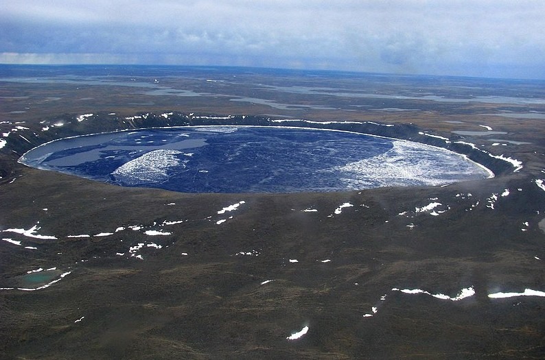
The Pingualuit Crater is formerly known as Chubb Crater and New Quebec Crater. It is relatively a younger impact crater located on the Ungava Peninsula in the administrative region of Nord-du-Quebec, in Quebec, Canada. The diameter of the Pingualuit Crater is 2.14 miles (3.44 km). It is estimated to be 1.4 million years old. The surroundings of the impact crater are now part of the Pingualuit National Park. Furthermore, the crater under the arctic sky is filled with pristine rainwater.
The pristine water inside the crater is isolated from the inlets of other lakes. However, it is 267 meters (876 feet) deep which allows scientists to look into the geological past. It has been estimated that Pingualuit Crater was formed during the Pleistocene Ice Age which began about 2.6 million years ago. However, the fragments found in the surrounding water bodies do not date back further than the last ice age.
Formation of Pingualuit Crater
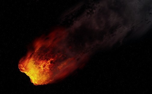
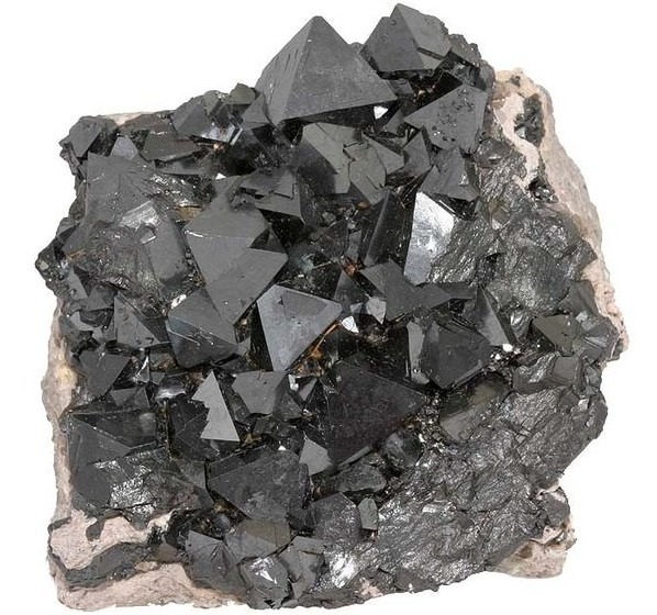
The crater was formed by a comet or meteorite impact hitting the earth’s surface which is now Quebec, Canada. It is estimated that a comet from our solar system hit the earth’s surface 1.4 million years ago. The analysis of the rocks found from the impact crater site has revealed the features of plane strain along with the composition of the meteorite.
The chromium, cobalt, nickel, and iron enrichments have been found in the melt samples which suggest that the meteorite was chondritic.
Geography of Pingualuit Crater
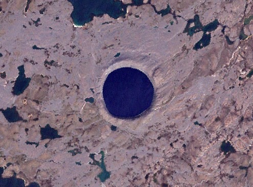
The crater is exposed to the surface. It rises 160 meters (520 feet) above the surrounding tundra with a depth of 400 meters (1,300 feet). Lake Pingualuk which is 267 meters (876 feet) deep fills the void and is known as one of the deepest lakes in North America. The lake contains some of the purest fresh water in the world. However, the salinity level is less than 3 ppm.
Pingualuit Crater’s Lake is one of the clearest lakes in the world with a Secchi disk visible approximately 35 meters (115 feet) deep. The lake has no inlets or outlets. However, it fills up with snow and rainwater.
First Observation of Pingualuit Crater
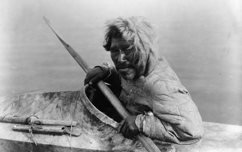
The lake-filled crater had been long known to the locals known as Inuit. They have been unknown to the outside world but they knew Pingualuit Crater as the crystal eye of Nunavik due to its clear water. During World War II, the nearly perfectly circular impact crater was used as a waypoint and navigational aid.
On June 20, 1943, a United States Army Air Force aircraft on a meteorological flight over the Ungava region of the province of Quebec took a photograph showing the wide rim of the crater rising above the landscape. In 1948, the Royal Canadian Air Force covered the same areas as part of its photo mapping of Canada program. These photographs were not made public until 1950.
Fredrick W. Chubb’s Expedition
Fredrick W. Chubb, an Ontario diamond prospector became interested in the strange terrain shown in the photographs. He sought the advice of V. Ben Meen, a geologist of the Royal Ontario Museum. It was Chubb’s opinion that the crater was to be that of an extinct volcano in which case the area could contain deposits of diamond similar to those in South Africa. However, the knowledge of Meen of Canadian geology tentatively ruled out the volcanic origin.
In 1950, Meen took a brief plane trip to the crater with Chubb. It was the trip where Meen came up with the name Chubb Crater for the circular impact crater and Museum Lake for the jagged body of water about 2 miles (3.2 km) north of the crater. It is now known as Laflamme Lake.
Upon his return, Meen organized a suitable expedition with the cooperation of the Royal Ontario Museum and the National Geographic Society. In 1951, the team traveled to the site in a PBY Seaplane landing near Museum Lake. The purpose of the expedition team was to find the nickel-iron fragments of the meteorite. The mine detectors were loaned by the United States military. However, they failed because the granite in the area contained high levels of magnetite.
A Magnetometer study found a magnetic anomaly below the northern rim of the crater. It indicated that a large mass of metal-bearing material was buried beneath the surface. In 1954, Meen led a second expedition to the crater. In the same year, the name of the crater was changed at the request of the Quebec Geographic Board to Cratere du Nouveau-Quebec which means New Quebec Crater.
James Boulger’s Expedition
In 1986, James Boulger led an expedition to collect a small sample of rock from the area surrounding the New Quebec Crater. Petrographic analysis was conducted on the sample at the Harvard Smithsonian Center for Astrophysics. In 1988, it was reported to the 51st Meteoritical Society by David Kring and Ursula Marvin.
Boulger returned to the Pingualuit Crater site with a research group led by M. A. Bouchard of the University of Montreal. Three years later, the New Quebec crater was listed among the 130 known terrestrial impact craters by Rich A. F. Grieve, a Canadian geologist. In 1992, Kring and Marvin documented the petrographic analysis of two impact melt samples collected from the Pingualuit Crater site.
In 1999, the name of New Quebec Crater was changed to Pingualuit. On January 1, 2004, the surrounding of the impact crater site became part of the Pingualuit National Park of Canada.
Expedition 2007
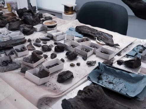
Laval University professor Reinhard Peinitz led a 2007 expedition to the crater to extract the sediment cores from the floor of the lake. It was full of insect larvae, algae, and pollen fossils. Like other craters on earth such as the Barringer Crater, there was no specific extraction of fragments of the meteorite.
However, the findings were expected to improve the information on climate change dating back to the last interglacial period which was 120,000 years ago. Preliminary results showed that the upper 8.5 meters (28 feet) sediment core contains records of two interglacial periods.
Cultural Significance of Pingualuit Crater
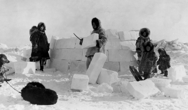
Pingualuit Crater was already known to the Nunamiuts. There are traces of stones and rock shelters arranged in a circular pattern. According to the Nunavik Parks, it is evidence of the place where ancient tents would have been erected. Furthermore, the traces suggest that the Nunamiut established camps on the ridges of the Pingualuit Crater while they were exploring the promising hunting grounds.
According to Canadian outdoor media, brand explorer, the Pingualuit region is known as Nunavingmi Pikkuminartuq in the Inuit language. It means a remarkable place where a person can revitalize.
Visiting Pingualuit Crater
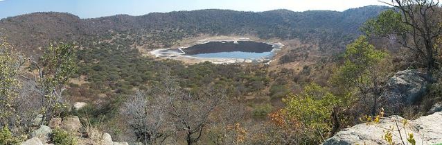
Pingualuit Crater was only accessible to Nunamiut and the most avid explorers. It is like other craters on earth such as the Gosses Bluff crater which is now accessible and preserved by the authorities. If you have a sense of adventure, you can enjoy a trip to the Pingualuit Crater. It depends on the time of the visit where you can enjoy a variety of activities in Pingualuit National Park.
When you visit Pingualuit Crater, you have to respect the cultural significance of the locals. However, one can enjoy hiking in the summer and cross-country skiing in the winter. Also, there are a variety of tours available via the Nunavik Parks.
Pingualuit Crater – 1.4 Million Years Old Impact Crater
Pingualuit Crater is located in the heart of the Ungava plateau. It is one of the top 10 craters on Earth that has been explored and preserved by the authorities. In this case, Pingualuit National Park works on the preservation of the 1.4 million years old impact crater. This impact crater is filled with pure rainwater where there are no inlets or outlets from other lakes in the surrounding area of the site.
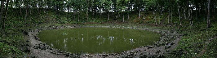
When it comes to scientific significance and exploration, there have been different expeditions led by several people over time. Pingualuit Crater is also known as Chubb Crater because Fredrick W. Chubb was the first person to explore this impact crater. Pingualuit Crater is like one of the other impact craters on earth such as Lonar Crater which has now become a lake. However, the impact crater site is filled with some of the purest fresh water in the world.