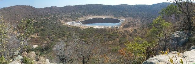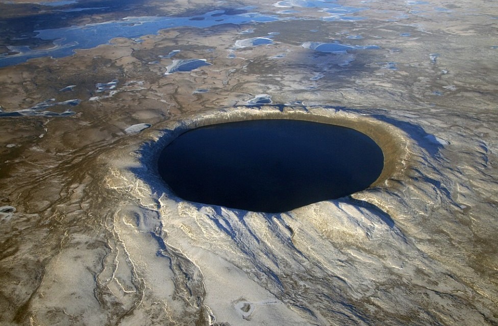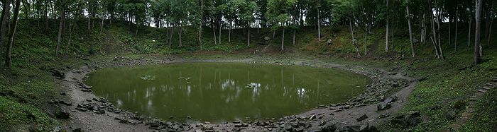
Craters On Earth – Roter Kamm Crater
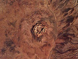
Roter Kamm Crater is a meteorite crater also known as Red Ridge. It is located in Sperrgebiet within the Namib Desert approximately 7.5 miles (12 km) southwest of Aurus Mountain and 50 miles (80 km) north of Oranjemund in the IIKaras Region. The diameter of the crater is 1.6 miles (2.5 km) and 130 meters (430 feet) deep. The estimated age of the Roter Kamm Crater is 5 million years ago during the Pliocene period. The impact crater is exposed to the surface but the floor of the crater is filled with deposits of sand approximately 100 meters (330 feet) thick.
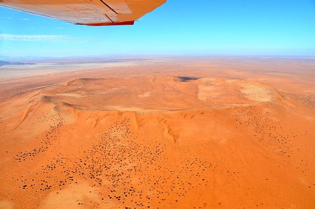
Amidst the rust-red dunes of the Namib Desert, the crater looks like one on Mars. The meteorite that hit the earth’s surface 5 million years ago was the size of a large vehicle. As a result, the crater has a rim at a height of 40 to 90 meters (131 to 295 feet) above the surrounding plains. Due to its location in the desert, it is not an easily accessible impact crater on earth. Furthermore, the restrictions to enter Diamond Area 1 makes it difficult to visit Roter Kamm Crater without permission from authorities.
Formation of Roter Kamm Crater

The meteorite struck a layer of Precambrian granitic gneiss which is part of the Namaqua Metamorphic Complex overlain by younger sedimentary rocks. A comet from our solar system hit the Earth’s surface which is now the Namib Desert. The impact gave a rise to the rim of the crater 40 to 90 meters (131 to 295 feet) above the surrounding plains. As a result, the surface was pushed down 130 meters (426 feet).
Over the years, the Roter Kamm Crater has been filled with deposits of sand which is 100 meters (330 feet). However, no part of the meteorite has been found from the impact crater site, suggesting that it had evaporated completely on impact. Furthermore, the meteorite that hit the earth’s surface was about the size of an SUV.
Scientific Significance of Roter Kamm Crater

Roter Kamm Crater is located in a restricted area of Namibia which is reserved for diamond mining. It was first observed by geologists in the 1960s. Roter Kamm Crater has been a part of debate like other craters on earth such as Lonar Crater if it is an impact or volcanic crater. In 1965, it was first proposed as a meteor crater.
In 1986, few people entered the remote part of the Namib Desert. Further research took place in 1987 and the origin of the Roter Kamm Crater was confirmed as an impact crater. In the 1990s, researchers proposed that a meteorite hit the earth’s surface about 3.7 million years ago. However, the research conducted in 2008 indicated that the Roter Kamm Crater was formed 4 to 5 million years ago during the Pliocene period.
The structure of Roter Kamm Crater exposes a large volume of mylonitic/cataclastic and pseudotachylite breccia in the basement gneisses and granite. However, it is unusual for small craters. Anomalous quarts found on the crater rim and primary fluid inclusions in the quarts appear to provide evidence of post-impact hydrothermal activity generated by heat during an impact.
Erosion of Roter Kamm Crater

Alluvial and Eolian processes have played an important role in modifying the Roter Kamm Impact Crater since its formation. It is like other craters on earth such as Gosses Bluff (Tnorala) that has become a victim of erosion. The recent history of modification in Roter Kamm Crater is related to the eolian processes. Furthermore, continuous wind erosion is responsible for eroding the exposed crater rims.
Gravity at Roter Kamm Crater
The expected gravity anomaly for Roter Kamm Crater is roughly circular. It is due to the sedimentary crater filling and associated low-density impact breccia with the high porosity of these lithologies. After standard data reductions including corrections for instrument drift elevation, significant topographical differences, and latitude, the gravity is generally circular. However, it extends to the edge of the crater or beyond it.
The shape and magnitude of the negative anomaly associated with other craters on earth such as Barringer Crater depend on several factors such as the size of the crater, the heterogeneity, and nature of target materials, the level of erosion, etc. Density, on the other hand, contrasts between the fractured target rocks, unaffected target material, and sedimentary fill in the case of Roter Kamm Crater.
Tsau ǁKhaeb Sperrgebiet National Park

Tsau ǁKhaeb National Park formerly known as Sperrgebiet is a forbidden area. It is a diamond mining area in southwestern Namibia also known as Diamond Area 1. It stretches across the Atlantic Ocean, off the coast from Oranjemund to the South African Border. It is located 45 miles (72 km) north of Lüderitz. The total area of the national park is 10,000 sq miles (26,000 km2) making three percent of the mass land of Namibia.
The mining only takes place in five percent of the Sperrgebiet with most of the area acting as a buffer zone. However, the public is not allowed to enter most of the area, despite the establishment of a national park in 2004.
History of National Park

In June 2004, the Sperrgebiet was designated as a national park which is now called Tsau ǁKhaeb National Park. The control of the area is under De Beers but they will hand over the control to the Namibian Ministry of Environment and Tourism. It will be done once the management plan for the park has been completed. Also, it is a proclaimed diamondiferous area that requires close monitoring to avoid any potential theft of diamonds.
In April 2008, a 500-year-old wreck of a ship called Bom Jesus was found in Sperrgebiet. It contained Iberian coins, copper, bronze, and ivory cannons. Under Namibian law, all the items found on board are entitled to the Namibian Government. However, they will be displayed in a museum in Oranjemund.
Roter Kamm Crater is located near several ghost towns in Sperrgebiet that were built in the 19th century. The best known are Elizabeth Bay, Pomona, and Kolmanskop. The wind has partially excavated several half-mummified bodies in a cemetery on the outskirts of one such ghost town.
Surroundings of Roter Kamm Crater

The location of the Roter Kamm Crater is near the mining area. The Sperrgebiet has a diverse fauna and flora due to little human intervention in the area for the past 100 years. The landscape is desert which makes up 40% of the area. However, there is 30% grassland and 28% rocky.
The surroundings of Roter Kamm Crater include Mount Aurus, Tsaus Mountains, Mount Höchster and the Klinghardt Mountains. Furthermore, there is a permanent water spring known as Kaukausib.
Roter Kamm Crater – A 5 Million Years Old Impact Crater
Roter Kamm Crater is located in Sperrgebiet, Namib Desert, South Africa. It is one of the top 10 craters on Earth that was formed 5 million years ago. The location of the Roter Kamm Crater is in the desert and close to Diamond Area 1. It is one of the impact craters on earth that are not easily accessible due to restrictions by the authorities.
Roter Kamm Crater is 130 meters (426 feet) deep but the 100 meters (330 feet) thick deposits of sand have covered the floor of the crater. It is estimated that in the next million years, Roter Kamm Crater is likely to be lost to the sands of time. Over time, it will not be visible from the air. If it is going to be covered in sand, it will look like a dune.