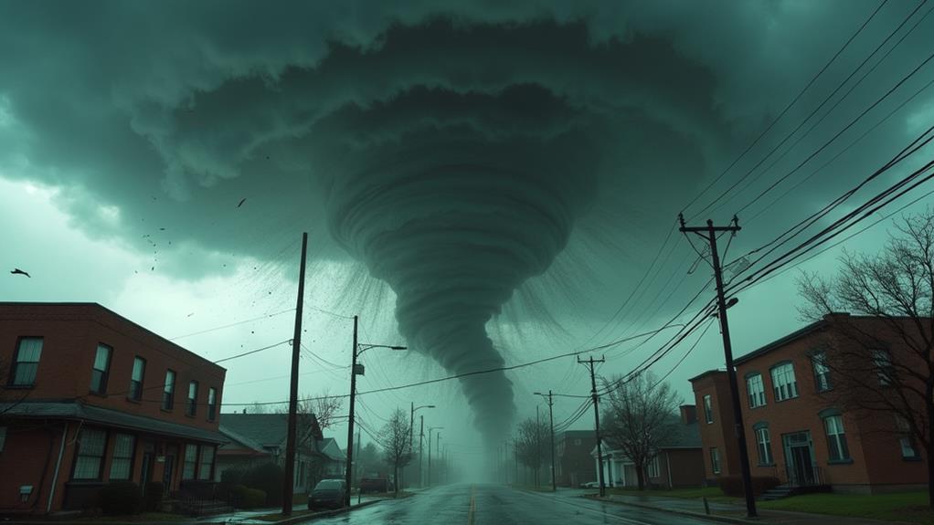
Why Do Atmospheric Rivers Cause Major Floods?
You might wonder why atmospheric rivers cause major floods. These are narrow corridors in the sky that transport immense water vapor, often carrying as much moisture as 15 Mississippi Rivers. When they hit mountain ranges, the moist air rises and cools, dumping heavy rain and snow that can overwhelm rivers and saturate the soil. Repeated storms increase the runoff, leading to severe flooding and infrastructure damage. With climate change making these events more frequent and intense, the risk of major floods grows. Uncover how these factors combine to shape regional weather patterns and flood risks.
Key Takeaways
- Atmospheric rivers transport immense water vapor, causing intense rainfall that leads to flooding.
- Orographic lift over mountains results in heavy precipitation and increased runoff.
- Consecutive atmospheric rivers saturate soil, amplifying flood risks.
- Warmer air from climate change increases moisture, intensifying rainfall and floods.
- Saturated ground from initial storms contributes to severe flooding from subsequent atmospheric rivers.
Definition of Atmospheric Rivers
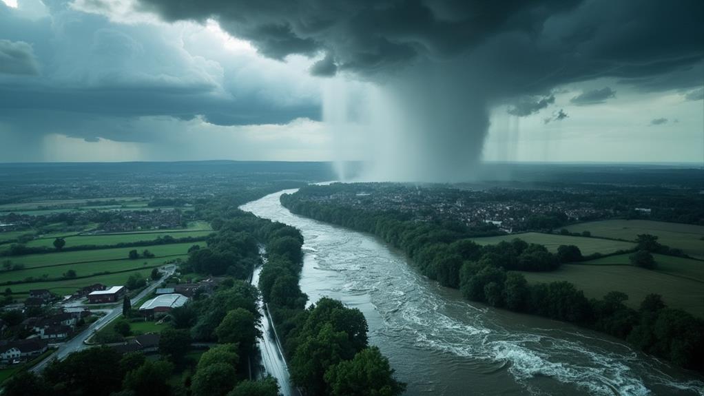
When you hear the term "atmospheric rivers," think of them as narrow, concentrated corridors in the sky that transport immense amounts of water vapor. These meteorological phenomena can extend up to 1,000 miles in length, carrying flow rates twice that of the Amazon River. They primarily form over warm tropical oceans, such as the Pacific Ocean, and are significant players in influencing weather patterns.
Atmospheric rivers have a profound impact on mid-latitude regions, especially when the concentrated water vapor encounters mountainous terrain. This collision forces the moisture to rise, leading to intense precipitation. In California, atmospheric rivers are responsible for 30-50% of the state's annual precipitation, which is vital for replenishing the Sierra Nevada mountains' snowpack.
However, the vast amounts of rain and snow they deliver can also lead to significant flooding. When these rivers of moisture release extreme amounts of water, the risk of floods and other weather-related impacts increases dramatically. Understanding atmospheric rivers helps us grasp how they shape regional weather patterns and contribute to both beneficial and hazardous weather events. So, next time you hear about an atmospheric river, remember its dual role in providing important moisture and posing potential flooding risks.
Mechanism of Moisture Transport
Atmospheric rivers transport moisture through long, narrow bands of concentrated water vapor, stretching up to 1,200 miles in length. These atmospheric rivers originate from warm tropical oceans, carrying immense amounts of water vapor, sometimes equivalent to 7.5 to 15 times the average flow of the Mississippi River. This moisture transport is propelled by strong winds that funnel the water vapor into narrow corridors, creating the perfect conditions for intense rainfall when the air rises and cools over land.
As these atmospheric rivers approach land, they often encounter mountain ranges, particularly along the U.S. West Coast. This is where orographic lift comes into play. The mountains force the moist air to ascend, causing the water vapor to condense into heavy precipitation. This process results in significant rainfall that can quickly saturate the ground, leading to potential flooding.
Atmospheric rivers are essential for the West Coast, providing 30-50% of its annual precipitation. While they are crucial for water supply, their intense and concentrated precipitation can also pose significant flood risks. Understanding the mechanism of moisture transport in atmospheric rivers helps you grasp why they can lead to major floods.
Role in Regional Weather

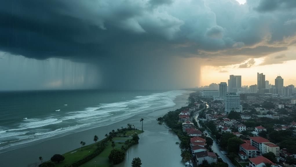
Understanding how atmospheric rivers transport moisture highlights their important role in shaping regional weather patterns. When these atmospheric rivers, such as the Pineapple Express, pull moisture from the tropics and deliver it to regions like California, they can account for up to 50% of California's annual precipitation. This influx of moisture is both a blessing and a curse. While it's vital for the water supply, the heavy rain that accompanies these events increases the flood risk dramatically.
When atmospheric rivers stall over a region, the prolonged periods of heavy rainfall can lead to extreme weather patterns. The mountains in California exacerbate this effect; they force the moist air to rise, causing more intense precipitation falls. This combination often results in severe flooding and mudslides, greatly impacting local communities.
Moreover, climate change is increasing the frequency and intensity of atmospheric rivers, further heightening the risk of extreme weather patterns and flooding. As these powerful weather systems become more common, they present an ever-growing challenge to managing California's water resources and mitigating flood risks. Understanding their behavior is vital for preparing and protecting vulnerable regions from the devastating impacts of these potent storms.
Back-to-Back Atmospheric Rivers
Back-to-back atmospheric rivers, known as AR families, pose a severe threat by considerably heightening the risk of flooding. When consecutive atmospheric rivers hit a region, the initial heavy rainfall saturates the soil. This soil saturation means that any subsequent storms result in increased runoff, exacerbating flooding conditions. For example, California experienced nine consecutive atmospheric rivers between December 2022 and January 2023, leading to severe flooding and extensive economic damage.
Research shows that consecutive atmospheric river events can cause 3-4 times more economic damage compared to single atmospheric river occurrences. This is due to their compounded effects on precipitation and flooding. Climate phenomena, such as the Madden-Julian Oscillation, can influence the formation and intensity of AR families, leading to more frequent and severe flooding events.
Understanding these weather patterns is essential for improving forecasting and water management strategies. By doing so, you can better mitigate the risks associated with back-to-back atmospheric rivers. Here are three key points to reflect upon:
- Soil Saturation: Initial storms leave the ground unable to absorb further rainfall.
- Increased Runoff: Subsequent storms cause more severe flooding.
- Economic Damage: The compounded effects lead to higher costs and more extensive damage.
Flood Risks and Impacts
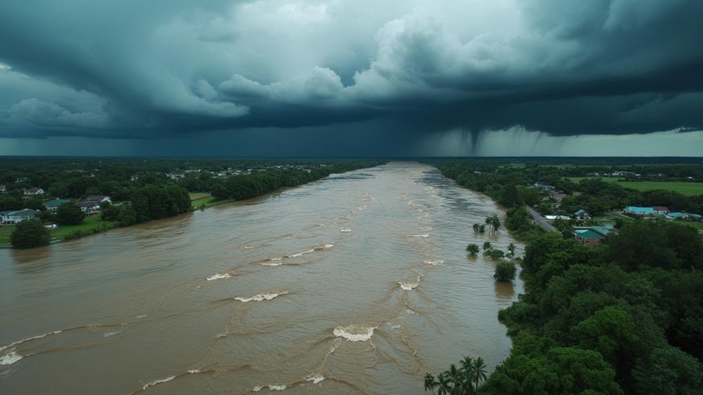
When regions face back-to-back atmospheric rivers, the danger extends beyond immediate flooding to broader flood risks and impacts. Consecutive atmospheric rivers, or AR families, exponentially increase flooding risks by saturating the ground with cumulative rainfall. This saturation leads to increased runoff, making areas 3-4 times more vulnerable compared to single atmospheric river events.
Consider California's experience between December 2022 and January 2023, where nine consecutive atmospheric rivers caused widespread flooding and infrastructure damage. These storms can deliver up to 50% of the state's annual precipitation, and when stalled over watersheds, they release extreme rainfall that triggers floods, mudslides, and significant infrastructure damage.
Compounding the issue, climate change is intensifying the frequency and severity of atmospheric rivers, contributing to more extreme flooding events. Research shows that AR families cause severe economic impacts, with damage far exceeding that of isolated storms. The increased likelihood of concurrent atmospheric rivers during wet conditions only heightens these risks.
Understanding the cumulative and devastating impacts of these weather phenomena underscores the need for improved forecasting, better infrastructure planning, and thorough flood management strategies to mitigate the severe economic and infrastructural damage they bring.
Water Supply Importance
Atmospheric rivers are fundamental for maintaining the water supply on the U.S. West Coast. These narrow corridors of extreme precipitation are responsible for 30-50% of the annual precipitation in this region, making them irreplaceable. For California, the Sierra Nevada snowpack accumulation is considerably enhanced by just one or two of these atmospheric rivers each winter. This accumulated snow is critical for the state's water resources, especially during the dry summer months.
Atmospheric rivers also replenish reservoirs and groundwater, which is imperative for supporting agriculture and ecosystems in drought-prone areas. In early 2023, record snowfall from atmospheric rivers filled Lake Oroville to full capacity, underscoring their significance in water storage systems.
Effective forecasting of atmospheric rivers is important for water management and flood risk mitigation. By accurately predicting these climate phenomena, you can better prepare for both water shortages and potential flooding, ensuring a dependable water supply.
Here's a visual representation of their significance:
- Annual Precipitation: Contribute 30-50% of the West Coast's annual precipitation.
- Snowpack Accumulation: Enhance winter snow levels in the Sierra Nevada.
- Water Management: Critical for replenishing reservoirs and groundwater in drought-prone areas.
Global Warming Effects
As we've seen, atmospheric rivers play an essential role in maintaining the water supply in the U.S. However, global warming is greatly altering their behavior. Warmer air can hold around 7% more moisture for each degree Celsius increase, leading to more intense atmospheric rivers. This extra moisture in the atmosphere results in heightened extreme precipitation events, which directly increases flooding risks.
Climate change, driven by rising sea surface temperatures, particularly during El Niño events, contributes to the more frequent and intense formation of these atmospheric rivers. Studies indicate that the frequency and severity of these events have climbed sharply, aligning with the broader trends of climate change. As a result, you can expect more severe and frequent flooding.
Climate models project that atmospheric rivers will become even wetter and stronger as the planet continues to warm. This poses considerable concerns for long-term water supply and flood management. The increased frequency and intensity of atmospheric rivers, directly tied to global warming, present a challenging issue. Effective strategies must be developed to mitigate these severe flooding outcomes and secure a reliable water supply in the face of climate change.
Research and Monitoring
NOAA's robust approach to studying atmospheric rivers utilizes a mix of satellite, radar, and aircraft observations to gather detailed data. By combining these tools, NOAA can monitor atmospheric rivers in real-time and predict their potential impacts. Improved numerical weather models augment understanding, allowing for better forecasting of heavy rain and flooding risks. This integration helps issue warnings 5-7 days in advance, giving communities critical time to prepare.
Continuous monitoring is fundamental for evaluating atmospheric rivers' influence on regional water supply and flood risks. Real-time data and historical patterns guide climate scientists in refining their forecasting techniques. This ongoing research is significant for reducing the uncertainty surrounding these weather events.
Research collaborations between institutions aim to further improve disaster preparedness strategies. By pooling resources and expertise, organizations can develop more accurate and timely warnings, ultimately saving lives and mitigating property damage.
Here's how NOAA's efforts break down:
- Observation Tools: Satellites, radar, and aircraft provide extensive real-time data.
- Forecasting Models: Numerical weather models enhance predictions of heavy rain and flood risks.
- Collaborative Research: Partnerships refine forecasting techniques and strengthen disaster preparedness.
Through these combined efforts, NOAA and its partners work tirelessly to protect communities from the severe impacts of atmospheric rivers.
Frequently Asked Questions
How Do Atmospheric Rivers Cause Flooding?
Atmospheric rivers cause flooding by altering precipitation patterns and transporting vast amounts of moisture. When they encounter geographical features like mountains, the moisture cools, condenses, and intensifies storms. Climatic variability can increase their intensity and duration, causing urban runoff and soil saturation. With inadequate flood preparedness, overwhelmed drainage systems lead to rapid flooding. Understanding these factors helps you grasp how atmospheric rivers contribute to severe flood events.
What Atmospheric Conditions Cause a Flood?
Picture a colossal river in the sky, bursting with moisture. You see, weather patterns and storm systems drive rainfall intensity. Temperature variations increase moisture transport, and wind dynamics guide these watery behemoths. When they hit mountainous terrain, topographic effects force air upwards, triggering downpours. The hydrological cycle can't keep up, causing floods. So, it's a mix of storm systems, wind, and terrain that brew these deluges.
How Bad Are Atmospheric Rivers?
Atmospheric rivers can be devastating. Their characteristics include carrying immense moisture, leading to high precipitation intensity. With climate change, these events are becoming more frequent and intense, impacting flood frequency patterns. Urban infrastructure is particularly vulnerable, and historical flood events show the potential for widespread damage. Effective meteorological forecasting techniques and disaster preparedness strategies are essential to mitigate risks. Understanding these dynamics helps communities brace for future atmospheric river impacts.
Why Do Floods Happen in Rivers?
Did you know that 90% of flood damage occurs on floodplains? Floods in rivers happen due to river dynamics and rainfall intensity overwhelming watershed characteristics. Effective floodplain management can mitigate this, but sediment transport and land use, like urbanization, complicate matters. Accurate flood prediction is essential to minimize damage. Deforestation and improper land use increase risks, impacting the ecosystem and highlighting the need for sustainable practices to manage ecological impact.