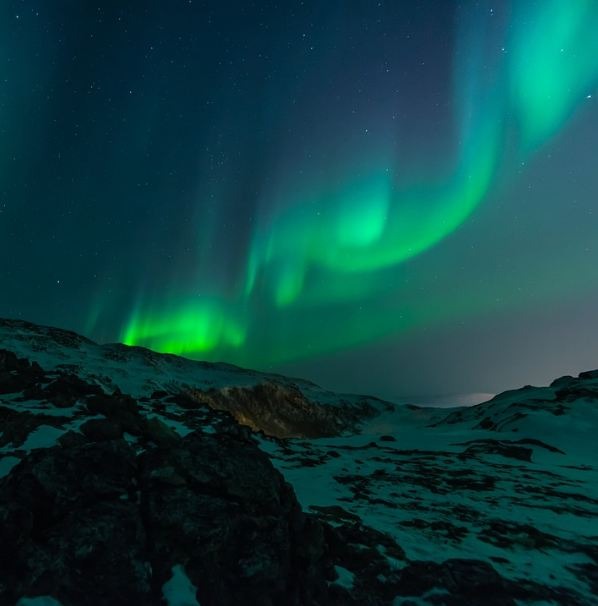
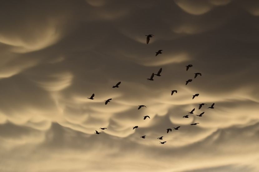
What Are Mammatus Clouds?
Whether you are a storm chaser that watches the sky to determine the weather or just fascinated by the beauty of their different formations and structure, clouds are a very important indicator of the current condition in a particular place and time.
Children love to draw them with different shapes according to their creative thinking, but they always color them white.
There are many kinds of clouds, but the three major types are cumulus, cirrus, and stratus. Under each of these types are many species of clouds with unique characteristics and weather messages that it tells.
If you have seen an unusual cloud formation that features a series of bulges or pouches emerging from the base of a cloud, then you have seen a Mammatus cloud. Let's learn more about this cloud type.
What Are Mammatus Clouds?
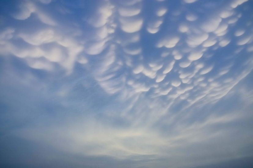
Mammatus are cellular patterns of pouches that dangle beneath the base of a cloud, usually a cumulonimbus raincloud, although they can also be related to other cloud types. Mamma is a supplemental cloud feature, not a genus, species, or variety of cloud, as per the WMO International Cloud Atlas.
In contrast to the puffs of clouds rising through the convection of warm air, the characteristic "lumpy" undersides are generated by cold air settling down to form the pockets. William Clement Ley was the first to describe these formations in 1894.
How Do Mammatus Clouds Form?
Mammatus got its name from the Latin "mamma," which means "breast." It has a striking pouch-like appearance that is most visible when the sun is low in the sky and the sunlight frames their pouches. This add-on feature is a much-favorite with many meteorologists and cloud and photography enthusiasts.
Mammatus clouds can have varying formations: from the classic protruding shape to a more elongated tube hanging from the cloud above. This cloud type is formed in connection with large cumulonimbus clouds.
The turbulence within the cumulonimbus cloud usually causes Mammatus to form, especially on the projecting anvil's underside, as it quickly goes down to lower levels. This is a reverse process than the usual cloud-forming process of upward growth, making for an uneven cloud base.
Although this type of cloud is uncommon, it can form in many places worldwide in the presence of necessary conditions for them to occur.
Mammatus clouds form when a strong upward current carries air with precipitation towards the cloud top. Due to the momentum loss, the air is caused to spread horizontally that further attaches to the anvil cloud. The presence of precipitation particles in high concentrations causes the denser air to sink than the surrounding air.
The descending air movement results in the rise in the air temperature, which causes the evaporation of the precipitation particles within it. Furthermore, if the evaporation requires more energy, the descending air will become cooler than the surrounding air surrounding. The descending motion continues and will lead to the formation of pouch-like patterns in the sky.
Characteristics
Anvil clouds and violent thunderstorms are frequently connected with mammatus. They are most commonly found in the foot of cumulonimbus clouds, although they can also be found in cirrus, altostratus, and volcanic ash clouds. Mammatus are often symptomatic of a particularly violent storm when they appear in cumulonimbus.
Aviators are highly advised to avoid cumulonimbus containing mammatus, as they imply convectively produced turbulence due to the extremely sheared atmosphere in which mammatus originate. Contrails can also form lobes, which are mistakenly referred to as mammatus.
Mammatus lobes can be ragged, smooth, or bumpy, as well as opaque or translucent. Because mammae are made up of lobes, the manner they clump together can range from a single cluster to fields of mammae that span hundreds of kilometers and are structured in a line, and they can be made up of unequal or similar-sized lobes.
Individual mammatus lobes have diameters of 1–3 kilometers (0.6–1.9 miles) and lengths of 12 kilometers on average (0.3 mi). A lobe can last anytime from 15 minutes to several hours, but an entire cluster of them can last from 15 minutes to many hours. They are normally made of ice, but they can also be made of a mixture of liquid water and ice or practically entirely of liquid water.
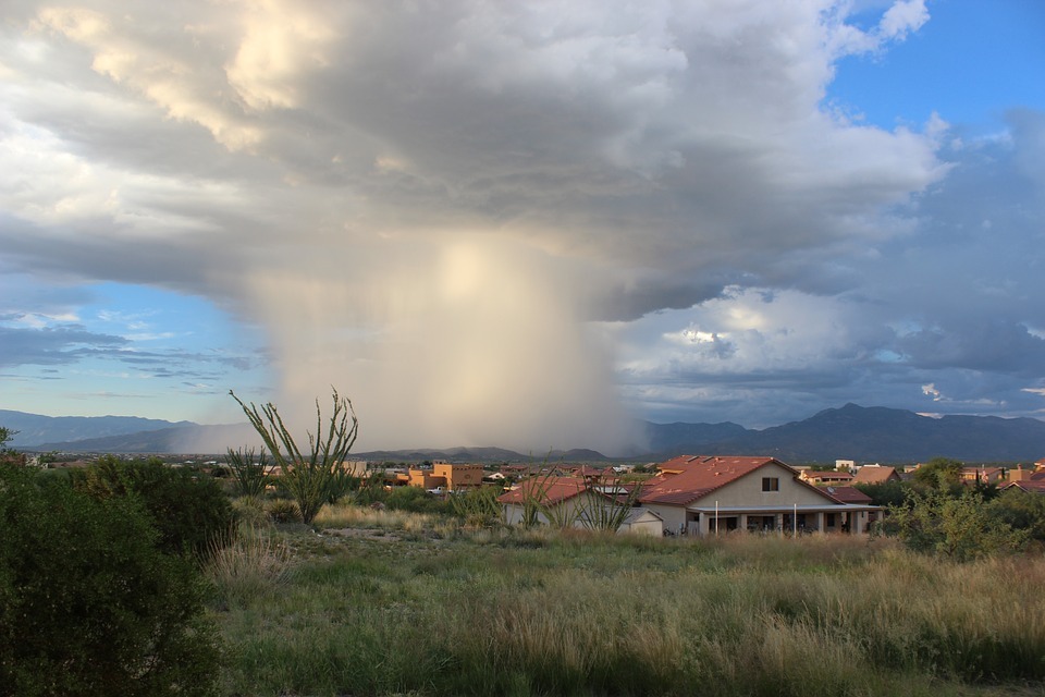
Mammatus clouds, with their gloomy aspect, are frequently harbingers of impending storms or other extreme weather systems. They can span for hundreds of kilometers in either way, and individual formations can stay visibly immobile for 10 - 15 minutes at a time, as they are mostly made of ice. While they may look ominous, they are simply messengers arriving before, during, and even after severe storms.
What Weather Is Associated With Mammatus Clouds?
Mammatus is often associated with Cumulonimbus clouds; it is also expected to bring thunderstorms because it contains massive unstable air. Since the cloud generally forms in the most unstable cumulonimbus, there is also a chance of hail, heavy rain, and lightning in the vicinity.
Additionally, during winter, when the air is cold enough, Mammatus clouds can produce snow. But in some rare instances, they may form on other cloud types that make no rain.
Did You Know?
In the United States, cumulonimbus mammatus is more common and frequently indicates a strong or tornadic storm. Such conditions can be hazardous to aviators, and air travelers, due to which they are warned against flying. Contrails caused by planes may also produce lobes but aren't considered as Mammatus.
Mammatus clouds may look smooth, rough, or clumpy lobes and either opaque or translucent. The clouds may appear as a clump of lobes, but their grouping together can vary from an isolated cluster to a field of Mammatus clouds spread over hundreds of kilometers to a linear either made up of unequal or similarly-sized lobes.
About 1-3 kilometers is the individual lobe's average diameter and lengths on average of 1⁄2 kilometer. Mammatus clouds can stay at an average of 10 minutes, but a whole cluster of mammas can range from 15 minutes to a few hours.
Hypothesized Formation Mechanisms
The prevalence of various types of mammatus clouds, each with its own set of attributes and occurring in diverse situations, has spawned a slew of theories about how they originate, many of which apply to other cloud types.
Sharp differences in moisture, temperature, and momentum (wind shear) across the anvil cloud or sub-cloud air border, which greatly influence interactions inside, are shared by all of the production mechanisms suggested for mammatus clouds.