The Different Types of Clouds
A cloud is a very light mass that consists of water drops and ice crystals present in the skies. They are formed through the condensation of the water vapor. There are different types of clouds based on their height in our skies and their shapes. Some examples of the main types of clouds are cumulus clouds, stratus clouds, and cirrus clouds. Aside from these main types, a cloud also has its particular types. Listed below are some special kinds of clouds.
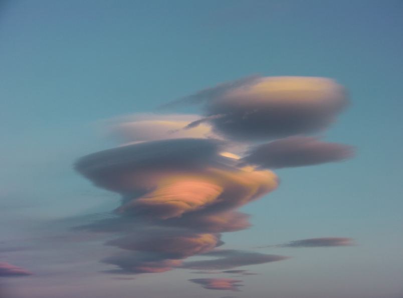
Lenticular Clouds
A lenticular cloud is a cloud that is usually in the shape of a lens or a saucer. Most of these clouds are located in the lowest layer of the Earth's atmosphere, the troposphere. This type of cloud originates mostly in mountainous areas when the moist air at the top of the mountains moves in a wave-like pattern.
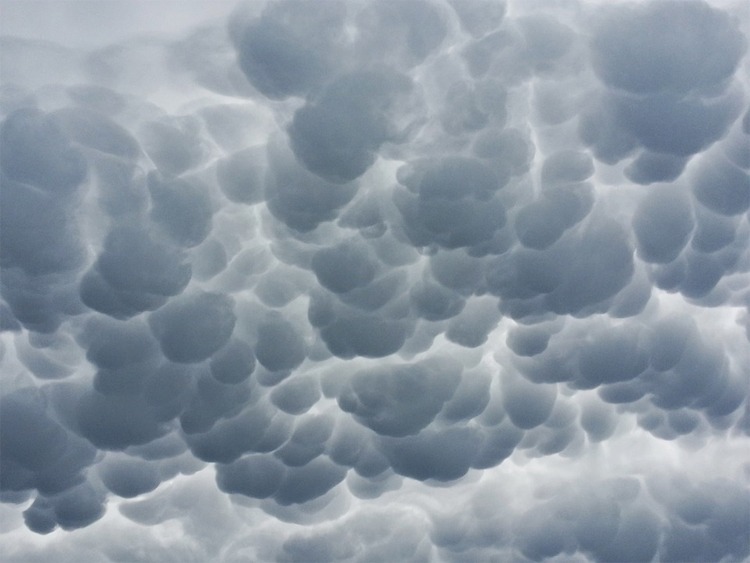
Mammatus Clouds
Mammatus clouds, which name comes from mamma that means "breast," is a cloud that resembles bulges and pouches that are draping in the skies. Due to its shape, this cloud is sometimes called the "mammary clouds." According to meteorologists, these clouds arise from cumulonimbus rainclouds. Mammatus clouds are formed when cold air falls and descends, forming the pouches of clouds in the sky. When these clouds show up in the sky, the weather would be bad and stormy weather, yet sometimes these clouds show up right after the bad weather is done.
Contrails
Contrails are also known as condensation trails. Contrails are caused by the engines of the aircraft that travel in the skies. These clouds are following the shape of a line. The contrails are formed when condensation in the aircraft's engine exhaust is combined with the low environmental air temperature at a very high altitude. These clouds contain water in the form of ice crystals. Contrails usually last for only a short period, sometimes seconds or minutes; this depends on the temperature and the amount of water vapor present at the given altitude.
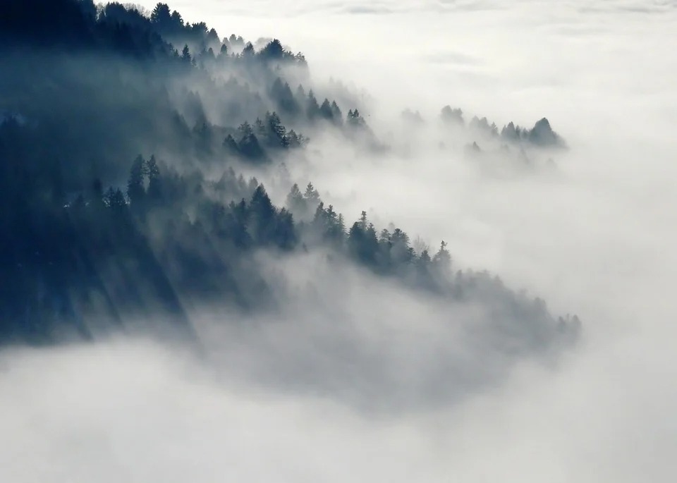
Fog
Fog is a special type of cloud that is seen near the lower ground. It can be classified as a stratus cloud. Fog is an example of the suspension of ice crystals and water droplets near the Earth's surface. This type of cloud often affects human activities as its presence can reduce the surroundings' visibility to more than a few feet.
Flammagenitus clouds
A flammagenitus clouds, also called the fire clouds, are formed through the intense heat on the Earth's surface due to forest fires, wildfires, or sometimes due to volcanic eruptions. These activities include water droplets, thus the formation of the clouds. These clouds can be triggered by the intense heat that causes atmospheric convection; wherein there is a presence of moisture in the atmosphere, which means that the air mass is rising until it is stable.
Cataractagenitus clouds
Cataractagenitus clouds are clouds that form from the water's spray by the waterfalls that are eventually broken up. The name cataractagenitus originated from the Latin word "cataracta," which means "waterfalls." These clouds are formed due to the downward current of the water from the falls and the air's upward motion. Cataractagenitus clouds are often considered a stratus type of clouds but can also be sometimes considered cumulus clouds.
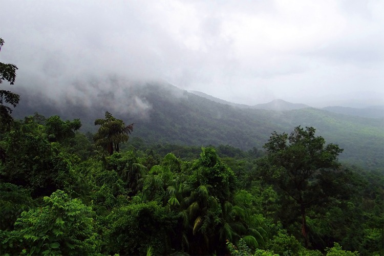
Silvagenitus Clouds
Silvagenitus clouds, from the Latin word "silva," which means "forest," are clouds that are formed because of forest evaporation. The evaporation and the evapotranspiration (happens when water from the leaves of the plants and the soil evaporates) causes these clouds to form. Silvagenitus clouds are usually seen near the lower Earth's surface, just hanging above the trees and the mountains on a dense forest. These clouds often appear during days where the humidity is high. Silvagenitus clouds can also be considered as stratus clouds.
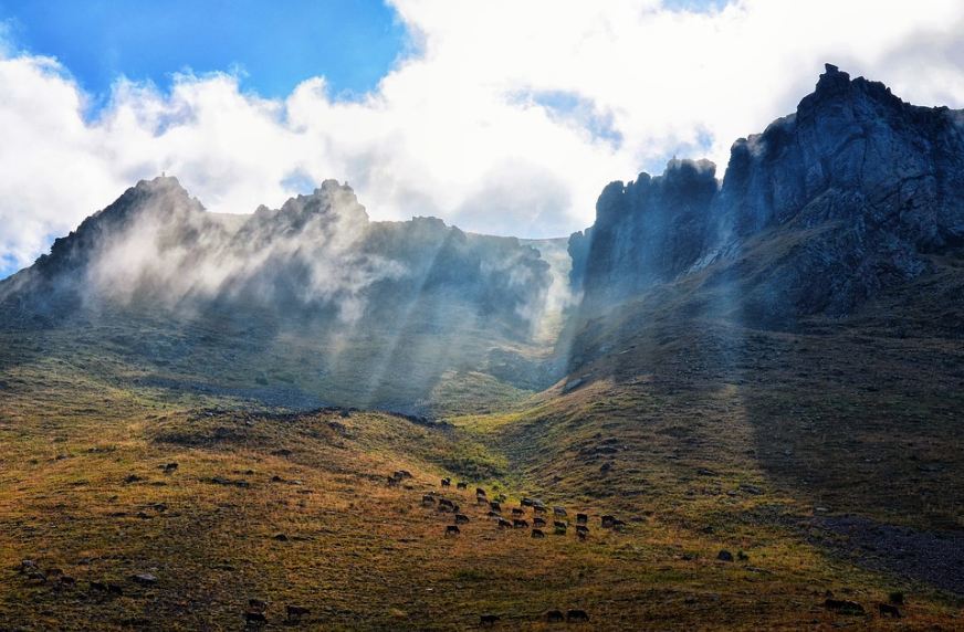
Orographic clouds
An orographic cloud is formed when the air is forcefully lifted around by the Earth's topography. The air on the hills or the mountains sways back and forth, and when it passes over a hill or a mountain, the air is lifted up and then cools as it rises. As the air that was lifted cools, the water vapor present in it condenses and eventually forms a cloud.
Homomutatus Clouds
Homomutatus clouds come from contrails from the aircraft engines or homogenitus clouds that eventually mutate into a more natural cirri-cloud appearance. After contrails are formed over time, strong upper-level winds tend to push and expand the clouds, developing them into a more natural-looking cloud.