What Are Cumulus Clouds?
Whether you are a nature-lover painter, a musician, a photographer, or a weather forecaster, clouds are essential subjects of life. One of the best views of the clouds is in sunny Los Angeles, California.
Clouds seem to contain some magic; they make people see many things in the sky-in one side are feathers; on the other side are cotton balls or some fluffy teddy bears. Some clouds bring rain, and some are just there to make your day and add to the beauty of the blue sky. They also make a stunning sunset seem even more beautiful. With your wide creative imagination, you can see lots of things in the cloud formations.
Clouds are made up of water droplets and sometimes very tiny ice crystals. They stay in different layers of the atmosphere and have different shapes and formations. There are also shapeless and formless clouds, but they are just there, either bringing some rain or not.
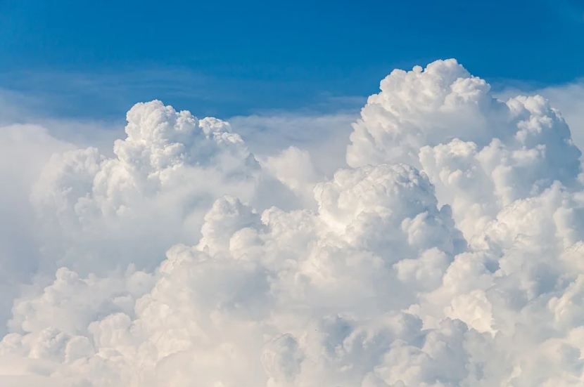
Cumulus clouds are perhaps the most famous type of clouds because they look so puffy, like cotton balls or cotton candies, and we love to draw them back to our preschool days. Let's find out more things about this type of cloud.
What Are Cumulus Clouds?
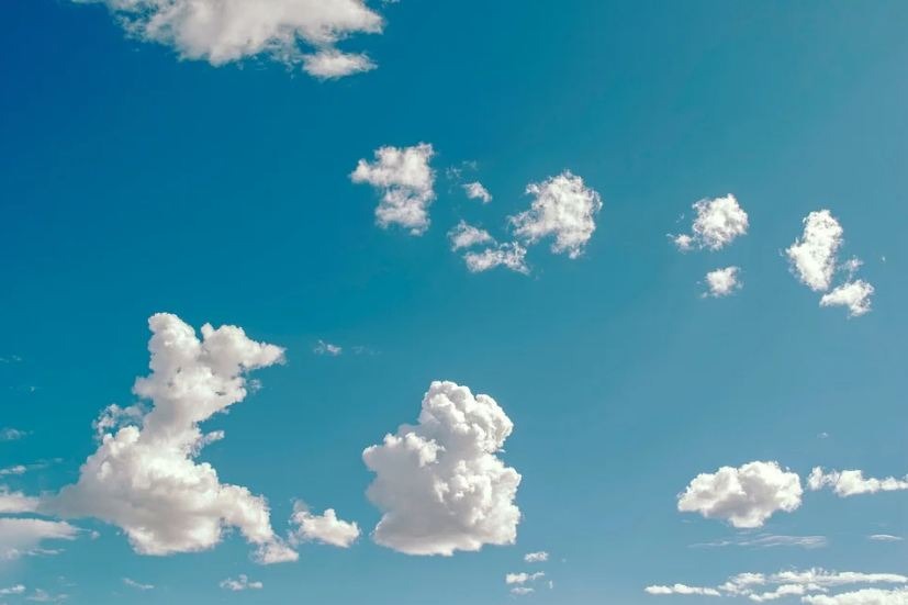
Cumulus clouds are separate, individual, in lines, or clusters clouds that come in many forms and shapes, such as cauliflower or cotton, because they are "puffy" and "fluffy" in appearance. They are low-level clouds; generally, less than 2,000 m (6,600 ft) in altitude, usually spotted in fair weather conditions, except for the cumulus congestus that are more vertical and can produce thunderstorms.
The name comes from the Latin word cumulo, meaning heap or pile. The cloud's tops are mostly brilliant white tufts when lit by the Sun, although their base is usually relatively dark.
Cumulus clouds usually appear before other cloud types, such as cumulonimbus, when influenced by other weather factors such as moisture, instability, and temperature gradient. Typically, they produce little to no precipitation, but they can grow into precipitation-bearing congestus or cumulonimbus clouds, as influenced by the factors mentioned above.
How Do Cumulus Clouds Form?
Convection causes the formation of all cumulus clouds. When the heated air at the surface is lifted, it cools, and water vapor condenses; thus, clouds are produced. When the condition extends longer, the clouds can grow in height and size and eventually form cumulonimbus clouds.
Along coastlines, cumulus formation can happen over land during daylight hours when the sea breeze brings in moist air that is eventually warmed by the surface. However, the effect reverses during the night because the sea becomes warmer than land, and cumulus forms over the sea.
There are four different types or species of cumulus clouds:
Cumulus humilis. This cumulus cloud is relatively wide than tall. You can see many of them in the sky, and they always tell a fair-weather condition during that day when you see them.
Cumulus mediocris. These cumulus clouds are both wide and tall and are usually seen amongst various other cumulus variations.
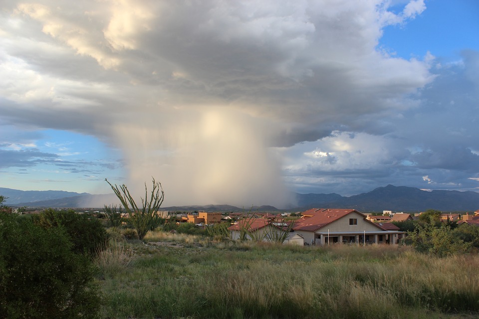
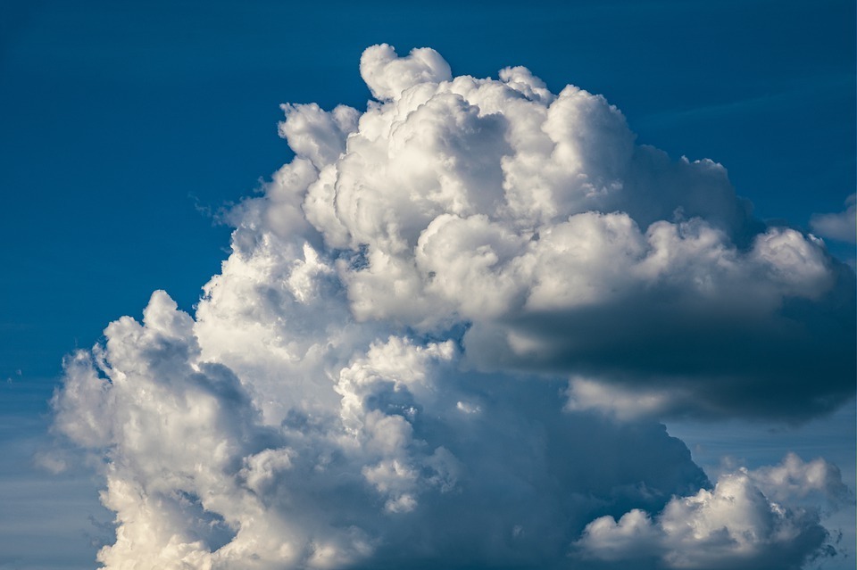
Cumulus congestus. This type of cumulus cloud is rather tall than wide, which resembles long chimneys. If their vertical growth continues, they can produce rain and eventually morph into a cumulonimbus cloud or thunderstorm.
Cumulus fractus. This type of cloud is breaking up or dissipating because they are remnants of the cumulus clouds. It might be visible in the evening as cumulus clouds start to dissipate, or perhaps on a windy day.
Description
The density of liquid water within a cumulus cloud changes with height above the cloud base instead of being relatively constant throughout the cloud. The liquid water concentration for every kilogram of air at the cloud base was 0 grams. The concentration rapidly grew as height increased, reaching a maximum in the cloud's center.
It was discovered that the highest concentration might be as high as 1.25 grams of water for every kilogram of air. As altitude ascended, the concentration gradually decreased until it reached the top of the cloud, when it plummeted to zero.
Cloud streets, which can be up to 480 kilometers (300 miles) long, can arise from cumulus clouds. These cloud streets may be fragmented or continuous and can cover large areas. They occur when horizontal circulation in the atmosphere is caused by wind shear, resulting in long, tubular cloud roadways. They develop during high-pressure systems, like those that follow a cold front.
The moisture content in the thermal that generates the cloud determines the height from which the cloud forms. A lower cloud base is usually associated with humid air.
The base of cumulus clouds is normally below 550 meters (1,800 feet) above ground level in temperate areas, but it can reach up to 2,400 meters (7,900 feet) in altitude. The cloud base in arid and mountainous places can exceed 6,100 meters (20,000 ft).
Water droplets, ice crystals, supercooled water droplets, or a combination of these can make up cumulus clouds. When there's a condensation of water vapor on the nuclei, water droplets form, which can then coalesce into increasingly large droplets.
Cloud bases in temperate zones ranged from 500-1,500 meters (1,600-4,900 feet) above ground level. The temperature of these clouds was usually over 25 degrees Celsius (77 degrees Fahrenheit), and the droplet concentration ranged from 23-1,300 droplets per cubic centimeter (380-21,300 per cubic inch).
What Weather Is Associated With Cumulus Clouds?
Generally, cumulus clouds are indicative of fair weather. They are friends with the Sun and are happy to brighten the day. However, when other elements come in and interfere, the cumulus clouds can grow into towering cumulus congestus or cumulonimbus clouds, which can produce heavy showers and thunderstorms.
What About Cumulonimbus Clouds?
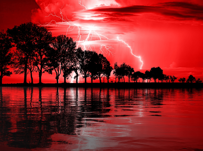
This type of cloud brings in thunderstorms. They came from cumulus congestus clouds that continue to grow vertically. They have dark bases not more than 300 meters above the Earth's surface, and their tops can extend upward to over 12,000 meters.
Within this type of cloud, enormous amounts of energy are released by the condensation of water vapor. Cumulonimbus clouds are associated with lightning, thunder, and even violent tornadoes. So, perhaps these clouds are not a good view to anyone except for storm chasers.