Everything You Need To Know About Asperatus Clouds
What clouds do you know? Can you recognize and differentiate which clouds are Cirrus and which formations are Cumulus or Stratus? We may generally call them just clouds, but there are many types of clouds up in the sky, and we must learn their differences as they are weather determinants.
Clouds are comprised of particles of water or very tiny ice crystals that travel in the sky as vapors or the gas form of water in the process of evaporation. Water that evaporates comes from rivers, lakes, seas, oceans, and even water from the clothes that we hang outside the house for drying. The gas form of water goes up in the atmosphere and gets cooler, and the pressure is lessened, so it cannot hold the water vapor than it once could.
Thus, the moisture forms a cloud. There are four main cloud types, but about 80 varieties exist and come in different sizes, shapes, thicknesses, and shades of clouds. They vary due to the factors that affect their formation, such as the air pressure, the altitude where they occur, and the way they are formed (warm front or cold front).
FOUR BASIC TYPES OF CLOUDS
1. Cirrus Clouds
The thin, wispy clouds seen high in the sky are known as cirrus clouds. They appear as if someone stretched a cloud and plucked bits off, similar to how a cotton ball is pulled apart. Because they are comprised of ice crystals rather than water droplets, they are very thin. A blue sky with a few cirrus clouds high in the sky usually indicates a pleasant day.
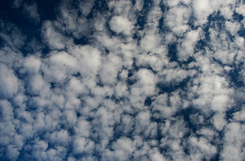
2. Cumulus Clouds
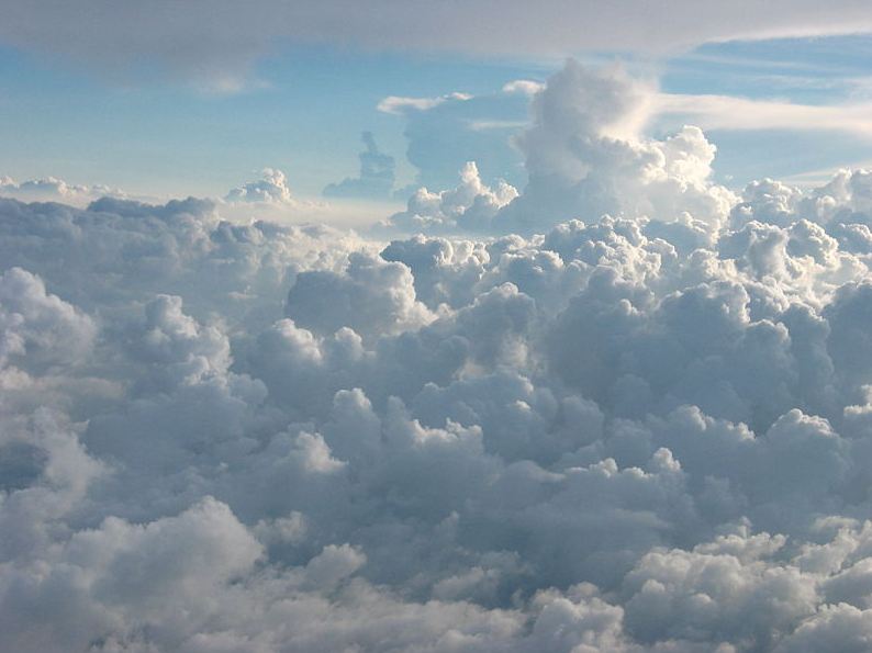
Cumulus clouds are puffy clouds that can be found strewn across the sky. Cumulus is a Latin term that means mound. Things pile up, and when they do, we say "accumulate." When warm air rises, it carries water vapor, forming this type of "accumulated" cloud. Cumulus clouds can be either white or gray. When the clouds are white and fluffy, it indicates a sunny day, but rain is coming if it is dark or gray.
3. Stratus Clouds
Stratus clouds appear to be a massive blanket enveloping the sky. If it's warm outside, these clouds are a clear sign of rain. If it's freezing, they're a sure sign of snow—fog forms when stratus clouds are close to the earth. Conversely, when the weather is frigid and warm air flows in, these clouds form. Two factors determine the thickness of the stratus cloud. First, the amount of moisture in the air and the temperature difference between warm and cold air.
4. Nimbus Clouds
The word nimbus refers to a cloud that is already raining or snowing. These black clouds appear during a storm and are accompanied by thunder and lightning. They can be a hybrid of two clouds, cumulonimbus (a fluffy black cloud with rain falling from it) or a stratonimbus (a dark blanket with rain pouring from it).
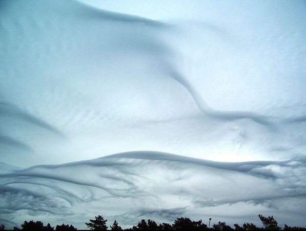
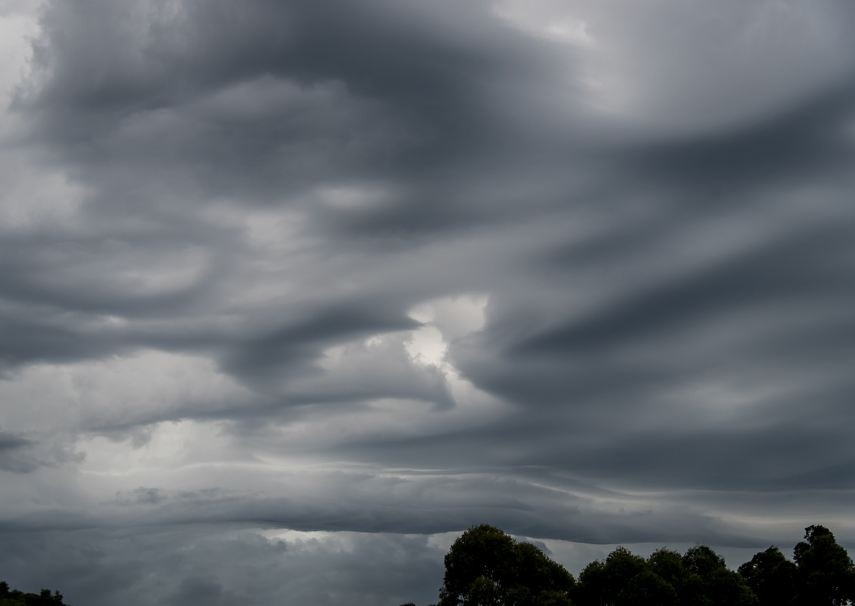
WHAT IS ASPERATUS CLOUDS
The latest addition to the clouds is named "asperatus," which in Latin means 'to make rough' as this refers to the turbulent and choppy undersides of the formations. Although some scientists said that asperatus could not be described by the recognized varieties, they should have their names. The Cloud Appreciation Society founder, Gavin Pretor-Pinney, calls it the "Jacques Cousteau cloud" because the cloud resembles a roiling ocean surface, as seen from below. He then suggested a much "formal," official Latin name: Undulusasperatus, which means "a very turbulent, violent, chaotic form of undulation."
Pretor-Pinney described the formations as local waves in the clouds' base, either smooth or speckled with smaller features, sometimes descending into sharp points as if viewing a roughened sea surface from below. They might be dramatic visual effects with varying levels of illumination and thickness of the cloud.
Asperitas clouds tend to be low-lying and occur below 2,000m (or higher with altocumulus) and are caused by weather fronts that create undulating waves in the atmosphere.
They might stir fear in some people who are very unfamiliar and have not seen this cloud formation. These clouds look downright apocalyptic, the ones you see on movies that feature end times, or Judgement Day or it looks like there is an incoming alien invasion. When you look at these clouds, something terrible is happening.
The National Center for Atmospheric Research, atmospheric scientist Margaret LeMone, considers asperatus a "likely" new cloud type. Meanwhile, an amateur photographer Jane Wiggins was credited with the recent buzz about the asperatus cloud formations. She photographed the viral photo from the window of a downtown office building in Cedar Rapids, Iowa, in June 2006. Her photographs were featured on the National Geographic website on June 3, 2009. Related news stories and photos quickly spread via the Internet.
To identify and determine the weather type in which the clouds appear, the Royal Meteorological Society gathered evidence to determine how they form. Then, they decided whether they were distinct from other undulatus clouds and should be submitted to the World Meteorological Organization for recognition.
The World Meteorological Organization recognized the last "new" cloud formation as cirrus intortus, added to its International Cloud Atlas in 1951. The latest ubiquitous use of digital cameras and the rarity of asperatus formations are the main reasons for this "new" discovery.
HOW DOES ASPERATUS FORM?
Although there are no concrete and accurate findings on how asperatus clouds form, there is a hypothesis that these wave-like clouds' existence is associated with the aftermath of convective thunderstorms. However, they have also been sighted in relatively calm environments.
Another theory suggests that the asperatus are formed when Mammatus clouds descend into the sky's areas where wind direction changes with height, causing the wave-like movement. However, atmospheric conditions must be unstable to form a wavy cloud base like that seen with asperatus.
WHAT WEATHER IS ASSOCIATED WITH ASPERATUS FORMATIONS?
Though the development of asperatus itself does not produce rainfall, they have been linked to thunderstorms occurring afterward. After all, it is likely that unstable atmospheric conditions are required to form these clouds. The wavy cloud base could also allow the growth of convective rain clouds, which means that other precipitation-producing clouds could accompany these asperatus clouds.