How to Predict the Weather with Clouds?

Weather prediction is an exciting quest, especially if your primary source of information is the cloud. Not only will you be able to anticipate weather conditions which can significantly help plan activities, protect ourselves from potential dangers, and help make informed decisions. While various methods and technologies are available for weather forecasting, observing and interpreting clouds is one simple yet effective way to predict the weather. Let this article guide you in using clouds to make sound weather judgments.
Cloud Categories and Types
Clouds play a crucial role in weather and climate, and understanding their different forms helps meteorologists and scientists predict and analyze atmospheric conditions. Here are some of the main cloud categories and types:
1. High Clouds
High clouds form between 16,000 and 43,000 feet. You only encounter these clouds atop tall mountains or at the sailing altitude of a jet plane. High clouds do not block sunlight. Because of the extreme conditions in which they form, they tend to be made up primarily of ice crystals.
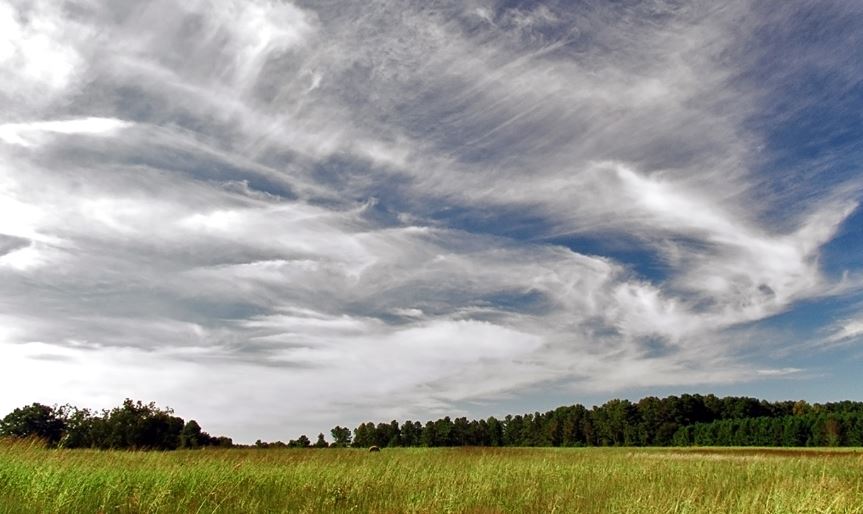
a. Cirrus: Thin, wispy clouds composed of ice crystals. They often appear feathery, and by all accounts, they can indicate fair weather in the immediate future, but changes in the next 24 hours in weather patterns are also possible.
b. Cirrostratus: Thin, sheet-like clouds that often cover the sky and create a halo effect around the sun or moon, which tends to see the sun or moon through them. Their presence usually indicates wet weather for the next 12 to 24 hours.
c. Cirrocumulus: Cirrocumulus clouds tend to be large groups of white streaks that sometimes seem perfectly aligned. In most climates, this means good weather for the foreseeable future.
2. Middle Clouds
Middle clouds create formations between 6,500 and 23,000 feet. They are made up of water and, if cold enough, ice. They often block sunlight, but only sometimes.
a. Altostratus: Gray or blue-gray clouds that often cover the sky and can lead to diffuse sunlight or a dull appearance. They are sometimes indicators of a storm very shortly since they usually precede bad weather.
b. Altocumulus: White or gray clouds with puffy shapes that can form parallel rows with much contrast between light and dark. They may indicate instability at mid-levels of the atmosphere. If you see them in the morning, stay indoors to be safe from thunderstorms in the afternoon.
3. Low Clouds
Low clouds form below 6,500 feet. These clouds are clouds that like to hang right above tall buildings. They tend to contain water but can also have snow if the weather is cold.
a. Stratus: Uniform, gray clouds that cover the sky like a blanket. They often get into formation when fog lifts off the ground. They can bring light precipitation or drizzle.

b. Stratocumulus: Low, lumpy clouds that vary in color and often occur in patches. They do not bring precipitation as they do not cover the entire sky.
c. Nimbostratus: Thick, dark clouds associated with continuous rain or snowfall. This is your standard rain cloud. It's a large flat gray cloud with a slight difference. If you see them, chances are it's raining outside.
4. Clouds with Vertical Mobility
Lastly, vertical growth clouds are typically low clouds with a base hanging below (5,000 feet) and a top that climbs high (over 50,000 feet).
a. Cumulus: Fluffy, white clouds with a flat base. They can grow vertically and develop into larger clouds. Cumulus clouds are your stereotypical white "cotton ball" clouds. The weather will be fine if the clouds remain low in the sky. However, keep an eye out for these clouds, as any vertical growth could signal the start of a major storm.
b. Cumulonimbus: Towering clouds that can produce thunderstorms, lightning, heavy rain, and even tornadoes. They extend vertically in the shape of an anvil. The anvil tends to point in the direction of the storm. These clouds bring the most dangerous weather conditions, such as rain, lightning, hail, and tornadoes. They are often associated with severe weather.
Predicting Weather Based on Cloud Formations

Now that we know the basic types of clouds, the following key to weather predictions is cloud movement. Remember, clouds are formed when water rises in the air and condenses into visible droplets or ice crystals. They come in different shapes, sizes, and altitudes, and each type of cloud can indicate specific weather patterns. By understanding the characteristics of different cloud types, one can make educated guesses about the weather ahead. Here are some essential tips before you make weather predictions:
1. Learn to identify the differences between clouds: cumulus and stratus and clouds at low, medium, and high- altitude levels.
Look at the sky and start identifying the clouds. If that is still a lot of work for you, a simple way is by looking at the clouds to determine if you can see the sun or moon through them. If you can, then you're looking at high-altitude clouds. If the clouds are thick, inclement weather can occur for the next day or two. If you can't see through clouds, you're most likely looking at clouds at medium to low altitudes.
2. Practice watching sequences of cloud changes, as they can tell you about storms.
Watch if the clouds move to determine when a storm is coming. If they appear stationary, it is a slow-moving front and likely will arrive for a maximum of a day. If they are moving, the weather changes will happen faster. You can tell which direction the storm is moving by the direction the clouds are heading.
3. Practice using all your senses to make better observations.
First, determine which of the two you're dealing with by observing shapes, colors, and other apparent signs. Do they cover the whole sky? Then it could be mid-altitude clouds. Do they appear to have bluish-gray or white/gray clouds with lots of contrast between light and dark? If so, these are average clouds; you should be prepared for rain over the next half day.
4. Pay attention to wind speed and direction.
The weather is fine if your clouds are low, fluffy, and white like cotton balls in the sky with the wind speed and direction on a steady basis. However, watch out for any clouds that grow vertically upward in the atmosphere (turning into an anvil). These clouds can suddenly turn from a sign of favorable weather to severe thunderstorms.
5. The two main types of clouds that produce rain are known as nimbostratus clouds and cumulonimbus clouds.
Remember, when the nimbostratus clouds arrive, many signs of a storm usually form within hours or even days. Meanwhile, cumulonimbus clouds are enormous clouds that have grown so large that violent rain comes from the bottom.
Rain Scenarios and Their Weather Predictions
Scenario # 1: Nimbostratus storms occur on the warm front of a low-lying area or whenever warm air pushes in and overlies cold air. Here's how to recognize a warm front and approach of nimbostratus clouds:
- The starting atmosphere is fair.
- Followed by high cirrus clouds moving inward, increasing in thickness and diversity.
- Then, the altostratus clouds began to move. These will appear from the same general direction of the sky as cirrus clouds.
- Finally, the bottom layer turns darker and denser, obscuring the sun.
- Darkness continues to intensify while nimbostratus forms overhead.

Scenario #2: Cumulonimbus clouds occur on the cold side of a depression or whenever cold air moves upstream to mix with warmer air above. This very different type of rain develops faster over hours rather than days.
- The morning starts relatively fresh and quiet. It can look like another sunny day.
- Early morning, you notice small, low-level cumulus clouds floating in the sky.
- As it heats up, these little blisters begin to expand. You start to see more and more signs of positive heat-induced growth.
- Eventually, these clouds became so crowded that they expanded outward and upward at breakneck speed.
- When clouds are large enough, they become cumulonimbus clouds and produce large amounts of rain, accompanied by hail, thunder, and tornadoes in severe cases.
Conclusion
One can learn about current and future weather conditions by observing and interpreting the characteristics of different cloud types, their movement, and their formation. It can save time and life when danger rises. However, it's important to note that while observing clouds can provide valuable information, modern weather forecasting involves a complex combination of data from various sources, including satellites, time stations, and more. Clouds are only part of the problem, and a comprehensive weather forecasting approach should be used for accurate results.